
Part I: Preparing for the big day
I guess you could call the rim-to-rim Grand Canyon day hike that I did a few weeks ago "prep" for the Mount Whitney hike, but either way, this just happened to be next on my list of things to climb on top of. :-) Wanting to find someone to climb with, I posted this trip on the WSA (Western Slope Adventurers) website, snagged up the last of the weekend permits for the summer, and next thing I know, I have 3 people as crazy as me ready to embark on another MJ adventure!! :-)
For those of you who don't know, Mount Whitney is near Lone Pine in California, about 1 hour from Bishop, 2.5 hours from Bakersfield, and less than 2 hours from my good friend Ralphie up in Mammoth Lakes. Why go all the way to CA to climb on top of a rock? Well... Mount Whitney is the tallest peak in the lower 48 states, towering over everything else at 14,508 feet (it actually used to only be 14,497 ft, but "grew" over the past few years when GPS became available to use instead of the old methods).
With 2 weeks to go, and a lot of excitement and energy, I learned that my blood levels took a sharp nose dive and were no better than they were 2 months ago. (For those of you who don't know, it's now been close to 2 months since I started taking iron infusions 3 times/week in an attempt to raise my low red blood cell count and get some O2 flowing through my veins.) Even though I admit to being a bit nervous about the possibility of passing out on the way up, I decided not to focus on the negative, and instead see what I could do to make the trip a successful one.
I had a PFT done and was surprised to learn that I have lung issues and need an inhaler (those who hike with me regularly and have to listen to my wheezing will be very happy now I'm sure). I also took the dogs and camped out up on top of the Grand Mesa a few nights after work (about 10,500 ft) in an attempt to acclimate. That weekend, I went with my friend Andy and drove up to the top of Mount Evans, climbing the last 100 feet to the 14,260 summit. (As you can see from this photo, it's the highest paved road you can drive on in the US and reaches over 14,100 ft!!


These were a few photos showing the scenery on the car ride up to Mt Evans.


We are now at the top (at least as far as the road would take us). The pile of rocks just past Andy's white 4-Runner is the summit.

We saw several mountain goats on the rock. Heck, if they can get up there, so can we! :-)


We had no trouble bypassing the snow and ice and climbed up to the summit block. We saw a few people with ice axes and crampons who had climbed up a steep mountaineer's route to reach the summit. Amazing! Even though it was only 100 feet that we climbed, I had no trouble breathing. Couldn't have been a better start to the day!!!


From there, Andy and I drove in good spirits to the the 4 Mile Creek campground and met a few WSA friends. We camped out at about 10,500 ft and would be doing some more "prep" climbing tomorrow.

Then after a fun night, we all drove up to the trailhead and climbed Mount Sherman. Dan and I decided to go exploring. I made a few small navigational errors that kept us far from the group, but we found a peak and decided to climb up it until we reached the top. It got a bit sketchy, but we summited what we later realized was Mt. Sheridan.


We then realized we were only at 13,000+ feet and looked to our right to find Mount Sherman (where the others from our group were headed). We found a trail down the loose scree, followed the ridge down into the saddle, and then headed up the snowy trail to summit that 14er as well.


Here are a few views from the summit. Only about an 8 mile day with 2700 ft of elevation gain, but this was the first hike I used my inhaler on (what a difference!) and we all made it successfully to the top WITHOUT dizziness or passing out!!! :-)


We met the others at the summit (or on the way up). Andy came back up to the summit to take a picture of Dan (he didn't bring a camera), so we all hiked (or skied, glisaded, slid, ran...) back down to the trailhead.

With only a few days left until the Whitney trip, this weekend sealed my decision to go!
Part II: Hiking Mount Whitney
I (and some other members of our group) had really wanted to climb up the mountaineer's route - a more dangerous, but exciting way to reach the top of the mountain, but after many calls to the ranger station, checking websites for trip reports, and checking the weather, we decided there was too much snow, and instead, we would be taking the main Whitney Portal trail.
Our group met up at Starvin Arvins in Fruita at 4:30 AM. We quickly loaded up Ron's truck and took off, making great time. It's about an 11 hour drive and we needed to get to the permit station by 4 PM, but as we later found out, with Ron's driving, very few stops/breaks, and an hour time difference, we arrived with plenty of time to spare!
The final 100 miles of the drive cut through Death Valley. Although we only saw the white salty crust of Badwater Basin from a distance - the lowest point in the lower 48 (which would have been cool to actually go there seeing as we were just about to reach the highest point) - we still got down to over 190 ft below sea level.
These are Death Valley's sand dunes.

Not a whole lot of life...

Near the end of Death Valley when the mountains came into view, we spent about 15-20 minutes trying to figure out which peak was Whitney. It was amazing to me how many photos we looked at and still couldn't figure it out! Ron just smiled... :-)
The first thing we did in Lone Pine was pick up our permit at the Visitor Center (which is right at the exit of Death Valley by Hwy 395). There was a tourist bus full of Asians (I wonder if they were the ones we saw the next day on the mountain?) and a great view of the Sierras.

The Visitors Center also gave us each a WAG bag, which is for us to do our business in and pack out if necessary. I hadn't seen John so excited than when he got this "present" from the ranger. LOL

With plenty of time until we had to retire for the evening, we checked into our motel and then went for a walk through Lone Pine. This poster was somewhere along the sidewalk and spelled out all the nearby peaks and activities to do in this little town. Can you spot Mount Whitney? :-)

John saw a pizza sign, so 3 of us decided to have dinner there. This may not have been the best pre-hike decision we had... The pizza was a bit burnt, and we weren't given anything to scoop up the pieces with (apparently people steal them?). Then there was the "salad bar", but no toppings to put on the salad (which is the fun part of a salad bar). The pizza didn't taste bad, but we went to bed with what felt like a rock in our tummies. Dan had stayed behind to eat food he brought. That was probably a smart move!

I slept well, but some of the other guys only got a few hours. Nerves and excitement perhaps? Either way, at 3:30 AM, the alarms went off and Ron got to work making the coffee. Despite the temptation, I stayed away from it as the inhaler was destined to make me jittery and I didn't want to add to it. The sandwich I had for breakfast was watery and mushed, so I opted to only have fruit. (Not a wise choice, my stomach would tell me along the first few miles of the hike as it growled in protest for some real food!)
We checked out of the motel and headed for the trailhead. The parking lots were already completely full, but we snuck into a spot, waited in line to use the bathroom, and then we started up the trail at 4:15 AM. Only 22 miles to go and 6125 ft of elevation left to climb. Can't wait!! :-)

About 1.5 miles in, we crossed over a couple of small creeks and came upon a sign for the North Fork. The next time we come, when we do the mountaineer's route (MR), we will be turning off here and taking the primitive trail to the start of the MR and E-ledges. Other than a few places that are packed down from use, there really is no trail - I need to make sure I'm going with some guys skilled in navigation and route finding or I have no idea where I'll end up. :-)

The sun was starting to come up slowly as we switchbacked up through the forest.


To my disappointment, we didn't spot any bear, but even at night with the sun just starting to rise, the views were impressive! There were a few headlights behind and in front of us, from other early risers.

We took a few water breaks, and used that time to stretch out and shed a few layers. Weather was warmer than expected, without a cloud in the sky. Ron had no layers to shed.

More creek crossings along the trail (lack of water wasn't an issue). This log crossing was one of my favorites.

A few miles in, where the trail went from dirt to rock and sand, we entered the Whitney Zone, where the permits were required and no dogs allowed.

Mt Whitney's peak wouldn't be visible for another few miles, but there were plenty of other rocks to look at along the way.

Here is a look back at the sun coming up over the part we had already hiked up. Making progress!

The sunlight gave the rocks a beautiful glow. Not a bad photo op!!

Next break area was time to ditch the knee brace until we start hiking down. We're getting close to tree line and my tummy was happy when I put a few calories in it.

Ron and I were playing on the rocks as we waited for the others. We had a lot of energy first thing in the morning.

This was one of the waterfalls we saw along the way. Sun, blue skies, white mountains, pines, water, and snow. What else could you ask for?

Mt Whitney's summit is still hidden to the right, but you can start to see the ridge we'd be hiking across way back there!

Another look back with the sun now above the mountains.

This was the last time all 4 of us were together before the summit. John was a real trooper. He had surgery a few days ago and didn't realize until later that the meds would make him sick. (He thought he was just a little out of shape or having a rough time with the altitude and long hike.) Despite that, he was still smiling as we were getting ready to ditch the trees and head up into the rocks. (Not sure I would have been able to do that under the circumstances!)

I don't hide my energy or excitement well (and don't really try to). We were all having a blast! :-)

This is a look at some of the rock we're going over and around. It was very tempting to ditch the trail and start scrambling up the rock, but (other than a few slips where Ron caught me cutting through switchbacks to sneak up rock), I managed to control those desires and stayed on the trail. John found a few places off trail to climb as well along the way. I think he's 1/2 monkey. :-)

Just off to the right in the very back (hidden behind the rock) is Mt Whitney. The ridge is visible from here.

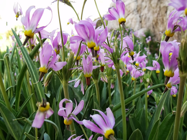
This was an area with a small creek, water cascading down some rock, and beautiful flowers.

Ron took some great shots of the flowers.

Here's another look back along the way up.

About 1/2 way there and still smiling. Everything was perfect!


These were two lakes that marked the start of the last 99 switchbacks. The bottom one I named "rust lake" (or "iron lake") due to it's reddish brown color. Maybe if I drank from it my iron levels would go up?

Love this shot of the wispy clouds that Ron captured over the mountains.


The trees were gone at this point, and there was just a little bit of ice and snow along the path, making some areas slippery. We were getting closer and closer to the ridge.


This is a closer look at the ridge, with Mt Whitney still off to the right and out of sight. I had mistakenly thought the summit was that sharp pointy high point. Ron corrected me. :-)

Here's a look back at the 2 lakes. We're getting higher!!!

Along the switchbacks were cables in one of the sections with a more steep dropoff.

You could now see the direction of the mountaineer's route and some of their lakes. I wished we weren't so high so we could cut across and sneak over to that route. There will be a next time...


At about 13,000-13,300 ft (depending on when I looked at my not-so-accurate altimeter), we took a food and water break and met up with Daniel again!


It was about 8 AM and time for another 2 puffs of the inhaler. Wow! What a difference the inhaler made! I had a vanilla energy gel, and between those two, I had so much energy I was ready to move! We said good-bye to Daniel and would see both him and John at the summit.

This was my favorite part of the hike. The final 2 miles were class 2, which basically means some fun rock hopping along the ridge. Check out those spires along the ridge crest. I think in my energetic state there were even a few places I started running. Ron is in fabulous shape and didn't seem the least bit phased by my new found energy. :-)


This was a little notch along the ridge that opened up and provided a very steep view down to the valley below, which I think was the mountaineer's route down there. This would not be a great place to fall!


Here, we are about 1/2 mile from the summit. I got a kick out of this snow as someone had cut a 3 foot deep trail in the snow to walk through. Not easy with poles, so I tried to keep my arms up and not slip. You could just bypass this section and climb up on the rocks, but it added to the fun.

Here's a look back along the open section of the ridge.

And finally, after a few more feet and 5 1/2 hours of hiking, we reached the summit at 14,508 ft! There were few others already there who had spent the night camping at different spots along the way. In this picture behind Ron is the summit hut. You can't get into it anymore, but it was still cool to see.

Normally you have only one summit marker, but on Mt Whitney, there were several. I started to rock hop and tried to stand on top of all the rocks just to make sure I had reached the highest rock on the summit. :-)

A look below from the other side showed Iceburg Lake 2400 ft down (still with ice and snow covering it). This is the mountaineer's route. At this point, the climbers would head from the lake to the rock and climb up a very steep 2000 ft chute (filled with snow and loose rocks) using ice axes, crampons, and rope if needed. From there, they would climb up 400 feet of vertical class 4 rock with serious exposure, and come out on the summit! I was a little disappointed that we hadn't gone that way as it didn't look like there was too much snow, but since we couldn't see the chute, well never know... Just another excuse to return. :-)

Despite not feeling so great, John made it up to the summit and posed for a few group photos before Ron and I started heading down. From left to right, you see Daniel, John, MJ, and Ron.


We did it!

And a few more views from the summit.


Ron and I said good-bye and let the others hang out at the summit for a bit longer. I was ready to start jogging / hiking fast down the mountain and Ron made for a great hiking partner as he not only kept up, but kept in good spirits and smiled the entire time. (I guess just putting up with my energy bursts is enough to make him a good hiking partner!) LOL


Coming back down the switchbacks, I turned around and you can see others hiking up at different levels.

Ron spotted more pretty flowers coming out of the rock on the way down.

This is one of the steeper parts. That's a long way down, but the mountaineer's route starts just on the other side of that down there!

The only thing I didn't like about the hike was that probably 30-40 people had left their used WAG bags on the side of the trail. How disgusting is that! We hope they will be picking them up on the way down, but it's not likely. Instead, other hikers or the rangers would probably end up picking these up.

This is one of those beautiful spots along the trail again. The water is cascading down the rock, there's a little bit of snow, a creek, and a field full of purple and orange flowers. We had made great progress at this point and decided to rest for a bit here.


We probably didn't need the water filter, but used it to refill the "tank" (at least 1/2 way) for the remaining hike down. Although it was cold (about 30 degrees with a light wind) at the summit, it was back to being warm again once we hit the trail, so those layers we had piled on came right back off again.

After passing a few camp sites and climbing down a bit further, we reached this open field. It was beautiful to look at, and a flat trail to hike through. This is also where I turned my head back to look at Ron while talking to him and walking along the trail. Didn't see the rock in the trail until my ankle twisted on it. Not a bad sprain, but enough to make me really slow down the rest of the way.

We saw a few guys with heavy packs, and girls carrying nothing. I had to sneer at the girls that would let their man carry all of their gear for them. (Amazing that the guys would be willing to do that!) Of course right after that I sprained my ankle and Ron offered to take my pack. I accepted his shoulder to lean on for a little bit instead. :-)
With only 3-4 miles to go, this was the part we hiked in the dark before. Ron was able to name all the fragrant plants, rose bushes, flowers and ferns (show off! :-). I just enjoyed their presence.

Here's a sequoia tree that was split. These huge trees stood out among the other pines and was a reminder that we were close to the sequoia national forest area.

Although much more difficult to cross with an ankle sprain, it was still a lot of fun! (The only downfall was that we were starting to get passed by some of the hikers we had passed previously. A small price to pay...)

About 1 mile left in the hike and I had to take another picture (in day light) of this rock face. It's not that high (about 1500-2000 feet above us), but was gorgeous!

Not sure if you can see from here, but this is the first place the parking lot became available. With still a lot of energy despite the ankle and having just hiked 22 miles, I was strangely sad to see the cars and know the hike was almost finished.

The ridge and summit (off to the right and way back there) looks so far away and high up from here. I guess at 11 miles away and 6000+ feet up, it really was. We've come a long way!


We made it down in 4 1/2 hours (not bad considering we had to slow down the last 4 miles), and at the end of the hike, we stopped in at the Whitney Portal store at the trailhead. They had food and BEER!!! (Never saw beer at the trailhead before!) Ron snagged a beer and I hesitantly refrained due to the amount of Ibuprofen I had taken, but we still bought t-shirts. After that, Ron helped me over to the creek, where I could ice my ankle in the freezing water (snow melt from the mountain). We still had another hour before Daniel and John were expected back, so we just relaxed, snacked a bit, and drank.

The guys (Daniel and John) made it down in good time, bought a souvenir t-shirt as well, and relaxed a little before heading back down to Lone Pine for a dinner and drink stop at the Mt Whitney Restaurant.

We all put on our new t-shirts and celebrated our accomplishment. We now have all reached the highest point in the lower 48. Until next time... :-)

