
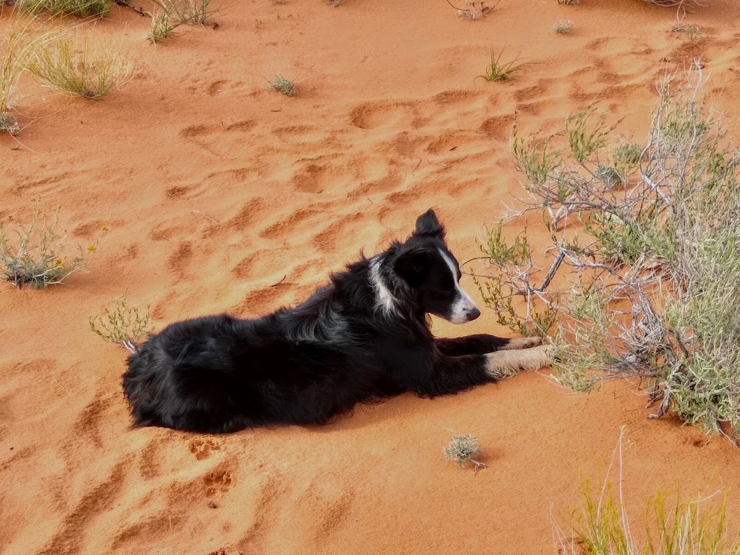
I no longer have a quality camera, so these pictures are courtesy of Ron. This is who I went on the trip with, in addition to our navigator and leader, a gorgeous 6 year old Border Collie called Macy G. :-)
Day 1 - Buckskin Gulch and exploratory hike
After watching Chris and Maribelle (my beautiful niece) perform a father / daughter dance at her end of year recital, Ron picked me up at 7:30 pm and we drove well into the night, finally stopping to camp in Sevier, UT.
We headed out early the next morning, stopped for a donut and coffee, and arrived in Kanab's Welcome Center for the Wave lottery an hour early. Macy was happy to have some 1-on-1 time for fetching a stick (a game she never grew tired of over the week).

For the first lottery, there were 180 ppl for 10 spots. They didn't start the lottery for the next day until 9 am, and after not getting selected, we waited until 10 am for the South Coyote Butte lottery (which we also did not get).
I didn't take any pictures of the lottery and found this one online in case you wanted to see how they picked people. Basically, it's a 30+ minute procedure. They take time to explain the conditions, weather, and experience you should have, what to bring, vehicle requirements, etc. Then everyone fills out an application for their group (1-6 ppl). Once they had all applications, each was assigned a number and the numbers were selected by about 9:30 am for the following day.

I like to get an early start to hiking, so I felt like 1/2 the day was wasted, but it was 70 degrees and sunny, so we opted to set up camp at Stateline Campsite (we miraculously found a spot despite the holiday) and then hiked for about 10 miles along Buckskin Gulch. This is our campsite! It even had a picnic table under a gazebo so your things could be out without getting wet in all the rain we had (and for shade from the sun). Not to mention it was FREE!!!! Best campsite ever! :-)

There was also an INCREDIBLE 360 degree view!
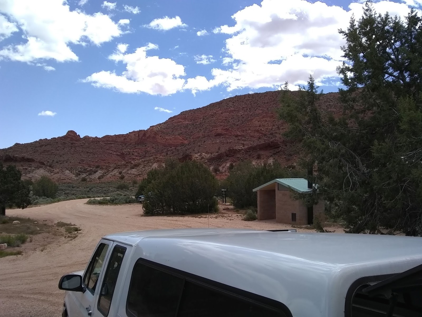
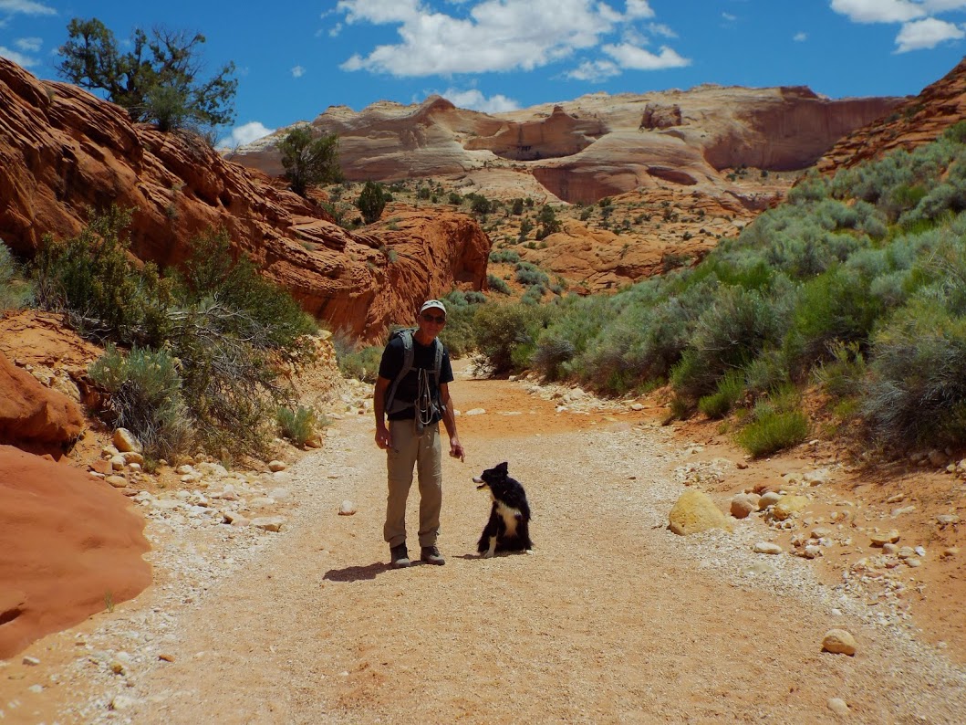
So... After spending a few minutes getting ready for the hike, we drove to Wire Pass Trailhead (just 3 miles from our campsite on a sandy, dirt road). Ron was kind enough to pay for the day permits and we started the hike.

The first 1.7 miles of hiking was in the Wire Pass wash in the sun and led to the confluence at the gulch. There was another trailhead as well, but this was the best choice for us - less time in the sun and less mud (more rocks and obstacles to move through).

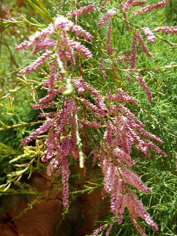
There were beautiful flowers this time of year that added to all the green (from so much rain). I have to say it was the most green I'd ever seen in the high desert!!!


The hike is listed as strenuous, probably due to some scrambling over rock, swimming/wading through water, and maneuvering through sand and mud, but I thought it was very easy hiking physically, and a great first hike to get all the leg muscles warmed up...


This beautiful slot canyon had areas of shade (so it was great for the warm, sunny weather), and had some amazing tall, narrow areas.


It does not require any rappelling or technical skills, though we had to turn around in one direction to avoid deep water crossing - the canyon can be fairly dry, but there was a lot of rain over the previous 1-2 weeks in the area.


You could go 15 miles each way, but we kept it to about a 10 mile hike. This is considered the longest slot canyon in the US, and possibly the world. It's also very "kid-friendly" (and dogs are allowed).


The rock was wavy and made some pretty neat formations!


Due to a deep pool of water preventing us from continuing on in one direction, we decided to turn around and follow the trail the opposite direction, bypassing the confluence, and leading toward the other trailhead. As you can see, it became much more open and exposed to the sun. There was also a lot more mud and fewer rocks this direction.


There was also a really cool formation that looked like an elephant's head/trunk!

After jumping over a few large potholes in a vain attempt to keep shoes from becoming wet and muddy inside, we discovered a gorgeous opening with a lot of green! This is where we decided to eat lunch and turn around.


All of these hikes we did are in the same general area (no more than 20 miles from our campsite), and they were all in the Paria Canyon and Vermilion Cliffs wilderness area, not far from the Escalante Staircase.

After this hike, we stopped back by the campsite to replenish our electrolytes - salty chips w/salsa, and celebrated the start to another adventure with a beer (after making sure we were hydrated, of course!). Macy had a blast in all the pools of water and ended up full of mud.

But... 10 miles wasn't enough. There was too much to do! We decided to check out the Maze Rock petroglyphs. The trail started 1 mile from the campsite and was beautiful! It went up and over a cliff, down into a pasture with desert plants, cacti, and cows, and then up 2/3 of another cliff. Very easy hike as it was all a dirt /sand trail with few rocks and no scrambling.


There was rock art portraying animals, people, and even mazes (hence the name)!


From there, we decided to continue with an off trail rock scramble up to the top of the cliff and over the ledge. We climbed down into an area between two more cliffs and spent the next hour or so exploring and climbing through sand, washes, and rock. It was so much fun!


After that, it was close to sunset, so we headed back just in time to don our headlamps. The cool weather that followed was welcome! We made a fire and had a lovely dinner before heading to bed.
Day 2 - Huntress Slot Canyon, Pink Sand Dunes, Inchworm Arch, White Castle
The next morning, we again drove into the city to try and get a Wave permit, and once again failed. However, we did get a permit to South Coyote Butte for tomorrow. This was our "rest day" with a LOT of 4x4 driving in tall sand and over rocks. Thankfully, Ron is an amazing 4x4 driver and the truck did not let us down!!! :-)
Since we were in Kanab, we decided to go on two short hikes that were on opposite sides of the town. The first was the only disappointment of the trip. It was Huntress Slot Canyon.
We followed the directions, but since very little on the sandy road was labeled, we ended up spending more time driving to find out where to go than actually hiking. We even stopped ask a Sheriff, who was the only other person we saw in the area, and despite new directions, we still couldn't find a distinct trail. So... We made a trail of our own and headed to the canyon.


The trail was full of sand, which gave our ankles and calves a great workout! In no time, we found the slot canyon (still no trail) and made our way to the start of it so we could hike around to the other, more rocky, side.
The canyon wasn't that great to look at, so we spent some time eating lunch and relaxing, and watching Macy try to catch lizards by this tree. :-)

Naturally, on the way back we spotted a trail. No interest in following it at this point as we had created one of our own that was (in my humble opinion) far superior! :-D
Anyway... We only hiked for 2-3 miles here, before heading off to the Pink Sand Dunes, which were nearby. It didn't really look "pink" to me, but the sand went on for miles and miles and was impressive!!!!!

You would expect to see the ocean nearby rather than just trees...


This may not look steep to you, but Macy was about the only one who could climb up it! We did enjoy "skiing" down this on the way back to the truck.

Lots of climbing up and down the deep sand dunes - not much mileage, but another great leg (and lung) workout! Sooooo much better than working out at the gym!!!!

Fun stop! And after that, we headed to Inchworm Arch. This was again not a long trail, but very scenic and different from other arches in the Moab/GJ area! Macy tried to make friends with another dog, but he got just a bit too excited and scared Macy with her howling. Reminded me of Duke (my sister's howling dog).
Can you find Macy and Ron?


The rocks around the formation and along the hike were beautiful as well.


Doesn't it look like an inchworm?

So many flowers growing out of the sand.


By the time we headed back to camp, we still had a few hours of daylight and wanted to make the most of it. So, rather than call it a day and eat dinner and relax like normal folks, Ron decided to take me to the closest thing to a fairyland - White Pocket! This has got to be one of the most amazing and hidden secrets in the Vermilion Cliffs area!


It was about 1.5 hrs of driving through rough rock and deep sand, but sooooo well worth it!


The rock was like someone stopped in the middle of making a fluffy dessert.


And other parts felt like I was inside a Dr. Seuss book!


The waviness of the rock fascinated me!


I could have played in these rocks all day. Felt like a little kid! I know the Wave is what drives tourists to this area, but I honestly think this was my favorite hike of the trip overall. It was just magical to me!


Because of the clouds (it rained almost as soon as we made it back to camp), the sunset was a creamy white, gray, pink, and orange, and matched the rocks and other scenery. You can't really tell in a picture, but it was incredibly scenic.


I kept seeing ice cream cones in the rocks. Is that a sign??? :-D

And of course, there were flowers blooming everywhere, especially along the trail to and from the truck and White Pocket!

As the sun set on the drive back, the jack rabbits were out and frequently crossed our path. It was so much fun to watch Macy whenever she spotted one! The cows were also out and seemed to like the 4x4 road as much as we did!
About 10:00 pm, we made it back to camp. Too late to start a fire, but Ron was able to cook us a nice dinner of Polish sausages on the camp grill he brought, and we finished off yesterday's potato salad as well. It was another great day, and as soon as we washed the dishes and went to bed, the rain started to fall...
Day 3 - South Coyote Butte
After nighttime showers, there was a beautiful double rainbow to look at as we ate breakfast and had coffee.

We decided to try one more time for the wave permit, and this time luck was in our corner! There were still over 100 people trying, but it seemed we would finally be able to see the Wave on the last day of our trip! (I should note that these 4 days are the only days I have ever tried to get a permit, but Ron has been trying since 2011, so I'm very happy he would have the chance to see it.)
We still had the permit for South Coyote Butte, which (if you're interested and win that lottery, is only $7 per person/dog). South Coyote Butte has two trailheads, but no defined trails. It's very remote and difficult to get to (unless you have a high clearance 4x4) and we didn't see another person all day!
The road was almost impassible from the rain, as there was very slippery clay and mud. I'm happy Ron was driving. My stomach was in knots as he showed off his mad crazy skills at correcting slides. Once we hit the sand though, it was actually easier.
Our first stop was Paw Hole. Hiking through the brush and sand, going from rock formation to rock formation was half the fun! I don't know how many miles we hiked today, but we hiked and climbed through the rocks and sand. It was another great workout, and the scenery was impressive!


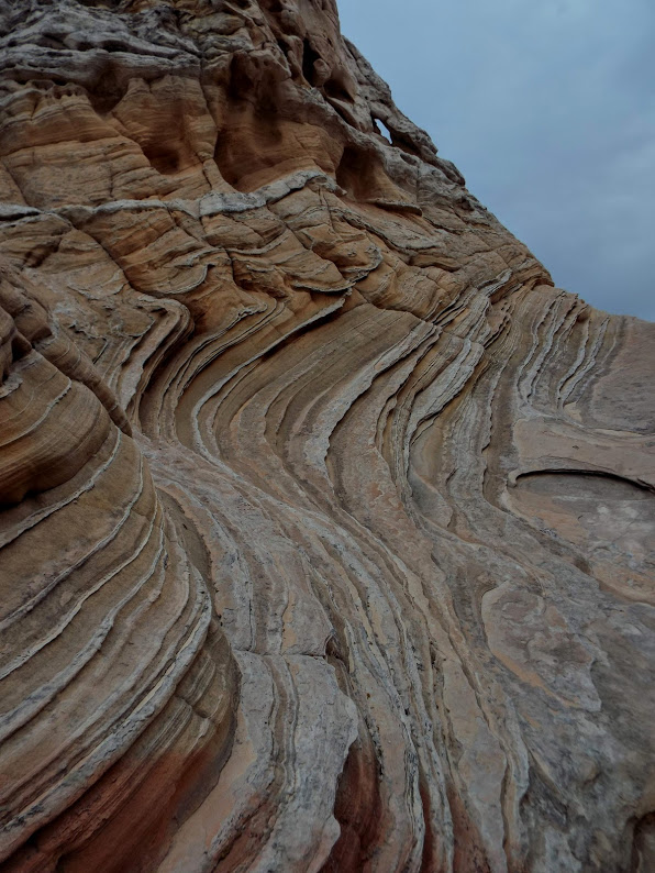
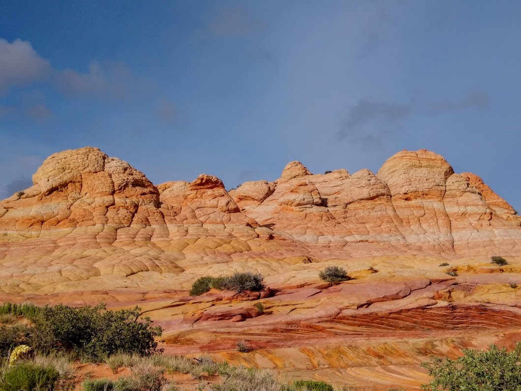
The sandstone rock formations were similar to that found at the Wave with the addition of lace (the thin rock that sticks out perpendicular to the lines in the sandstone).

This is a good example of lace. It's very fragile sandstone.

I don't know if you can see the snow in the picture below, but it was snowing pretty good on us for awhile!


There were some individual rocks to look at, climb, and walk around, taking in the contrasts in colors and lines/waves.


And there were other formations you could climb and walk through, discovering hidden gems in some of the rocks.


It stopped snowing, but the wind was honking and it was still cold, so I kept my 2 (yes 2) wool sweaters on, and rain jacket. The day pack almost didn't fit around my waist with all the layers!! But I was warm! :-)


This was one of my favorite areas to walk/climb through. Lots of going up and down and trying to find new places to explore. You had to be careful walking as the sandstone had some overhangs and broke easily.


You can see the variety of color - yellows, pinks, reds, browns... Sunset colors in the rocks. So pretty!!


At this point it was starting to drizzle. I took off the larger wool sweater and we climbed up a ridge with a gorgeous overlook to have lunch. The wind picked up and it got cold as we had stopped moving, but even with the clouds, snow, and rain, this was an amazingly beautiful day!!!

What a great hiking partner!


I wonder what's behind these rocks? The yellow and pink was beautiful and we decided to continue exploring the other side.

Good thing we did! Another hidden jem!!

You're never too old to play hide and seek. Can you find me Macy?

Ron helped find a way into another area with lots of lace before we hiked back to the truck to set off for the other trailhead.

As usual, we were packing in a very full day! The second trailhead was Cottonwood Cove. We also saw no other people on this hike, so it was just Ron, Macy G, and I all day!


The flowers survived the light snow and were flourishing!


Gotta love these rocks! :-)

The spiral.

More rocks to scale.


You can see similar patterns of lines and waves in the sandstone on this side as well.


This looked like a crazy castle! Let's climb to the top!


The view from the top is always incredible!


Ron found what looks like the world's tiniest arch! Smaller than the size of your pinky...


I don't know if you can see all the different colored layers in the rock, from light pink and yellow at the bottom, to browns and rust colored reds higher up.

This was a favorite of mine! It looked like someone was painting a line on the road and was too lazy to move the rock, so he just pained the lines over it. So many of the rock formations were like this. All of the colors line up despite being flat or raised. It's impressive!

I can't get enough of these different colored rocks. Better than a painting!

Macy is taking a rare break from retrieving sticks and chasing lizards and rabbits.
Some "painted" rocks were small and others towered over the rest!

And some of the colored lines were very delicate and thin, as if someone used a ruler and markers of different thickness to create the image.

Macy found more lace sandstone coming up through the sand.


There was so much to look at!
And such variety in the colors.


It was about 7:30 pm and as we climbed higher to get a view over the rocks, the wind and cold picked up. Time to add another layer and switch out my sun hat for my winter hat!


So much variety in the size, color, patterns, and shape of the rock. I was in hiking heaven!!!

Just when you think you saw everything, you hike over to another rock formation and see rich oranges and deep reds.


We kept walking around and through formations, eager to see as much as possible before the sun came down.


Then around 8 pm the sun made an appearance.

And Macy found more sticks for me to throw. Reminded me of Daisy... My sister's old black lab, and one of the greatest dogs I've ever met!

There were no rocks that disappointed us today! Everything was new, different, unique, and exciting.

So much beauty. Pictures don't do it justice!


On the way back, we found one distant set of rocks that we were going to bypass as it was quite out of the way, but luckily we took the time to hike over to them. The outside didn't look like much, but after we climbed over and into the middle of them, this is what we saw!!!!! :-O

More great pictures of the rocks with the sun hitting them as we made our way back to the truck.

This is the top of one set of rocks. You can see there is a little bit of distance between them and no trails. Good thing Ron was with me as I have NO sense of direction!!!

I started loving pink and orange during this trip! :-)

Ron's main camera had run out of battery and he had to resort to trying out the camera on his new cell phone. Luck for us, they turned out incredibly well as you can see!


I just could not get enough time climbing over these rocks and admiring them.

The way back was just as beautiful as the way in!


If you are in this area, I strongly recommend trying to get a permit for South Coyote Butte. It's a lot easier to get than the Wave permit as most people leave after that drawing. (The day we got the permit there weren't even enough people to have a lottery, and as you can see, none of the other people who won the lottery even showed up!)
It is a bit out of the way and you do need a high clearance 4x4 vehicle, but it's well worth it!!!!

We drove home as the sun set. My legs were feeling it as there was a lot of sand to hike through and we climbed quite a bit up and down the rocks, but it was a great feeling! I wasn't sure anything could beat today!
When we got back to camp, I barely had the energy to take my shoes off, but Ron cooked some incredible spinach tortellini that only took a few minutes to make, and it was so delicious after all of that hiking!!!! Couldn't ask for a better hiking companion!
Day 4 - North Coyote Butte (aka The Wave) and the Toadstools
On our final day, we no longer had to drive into the town of Kanab to sit through the lottery. Ron and I decided that since we had all day to explore the Wave, we wanted to find a unique way into it from the cliffs on the opposite side (the wave itself is only 3 miles). With the regular route (our backup), we would just be going back on Wire Pass trailhead until the start of the Wave, which apparently wouldn't have been as exciting. LOL
After 2.5 hours of scrambling up numerous rock formations and cliffs, we finally scaled one that led into the North Coyote Butte wilderness. We spent another hour trying to figure out how to get down into it, and just as I was beginning to think we needed to backtrack and go the "normal way", Ron led us around toward the Vermilion Cliffs and we descended through sand and rock into the valley. I have to admit that it was worth the hard work, and I felt like a new explorer finding some magical land!
I admit it was quite a workout, but cloudy and not super hot, and Macy had already found pools of water to soak in and drink from.

One cool thing about not going the "tourist way" is that we once again didn't see anyone until we came to the more touristy and well known formations. What most of those people didn't know is that if they kept going and climbing over rock to reach the other 1/2 of the North Coyote Butte wilderness area, they would find many more Wave-like formations!!! The first ones we came upon were the Outer Buttes.


Everything looked like "the Wave" to me. I couldn't get enough of it all!!


All of the rock, even on the ground we walked on, was different colors and interesting!

There was no "one way" to go, so we picked a side and just started hiking and exploring.


Could you imagine being the first person to discover this area?!?

You can see that sometimes we are in the valley and other times we are high up on the rocks. Lots of climbing today as well, but you'll soon see that the views from above are just as amazing as those from the valley!


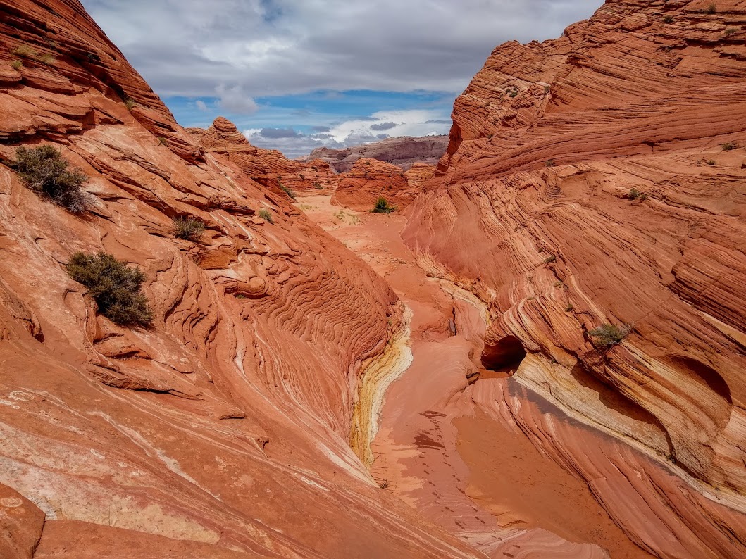
Hiking through canyons of colored, streaked sandstone.


Yellows, oranges, and pinks everywhere!!!


A look from the center on top of the highest rocks.


This formation (below) is all light yellow and pink. Interesting designs in the rock!


More wavy canyons to hike through.


There are names for many of these formations, but I have no idea what names go with what formations. I guess I will need to come back... LOL


It's impossible not to have a great time here!


Macy was kept happy as we played fetch with the endless supply of sticks she brought us throughout the day.

How many dogs get to play fetch in a place like this???

Okay, so it was "only" 3 miles, but there was soooo much to explore!!!


Macy is demonstrating how to climb on the fragile rock.


Rock heaven!


An arch off in the distance.

Hiking up and down through one set of rock after another. Canyons of swirling rock formations and sand.


Such a beautiful place to hike and climb.

Come on MJ. Throw the stick again!!!

So blessed to be able to be at such an incredible place. I don't have the words to adequately describe it. I was continuously in awe of the natural beauty of this wilderness.


This is I believe the "second wave". The tourists we saw were ALL at the first (and main) Wave formation, but we didn't see any venture out past that!!!!! Look at all they were missing!

What happened here?

Is this not the coolest canyon!?!?


Do we have to keep going or can we stay here all day???


Still, no other tourists!!!! All of this to ourselves!


And now we found the main Wave formation!


We had to explore all angles and sides - top to bottom!!

The back end of the Wave.

Approaching the Wave from a different angle.

Looking into the "Wave" from above.

Other formations brushed with bright yellow.


And of course, there were lots of flowers.


Since we had a 6.5 hour drive ahead of us (and still needed to figure out how to hike/climb back over the cliffs to find where we parked, we needed to start heading back.
Luckily, we found new formations and canyons to hike through!


About 1/2 way out we ran into a number of large rocks that looked like they were wrapped in yarn.

One of the cliffs we scaled over.


View from the top of the first cliff into the North Coyote Butte wilderness.


Many more flowers along the way back. Beauty in everything.


And finally, we made it back to the truck. What a day!!!!! As we ate and packed up at our campsite, we realized it would be about 1:00 am before we made it back into GJ (and even further for Ron to get home). We should have just stopped and camped along the way, but decided to drive through.
And despite the time, Ron asked if I wanted to stop and do some more hiking to see the toadstools. I had not realized how long the drive was at this time and said "of course!!".
Luckily this hike was only a mile each way, but it was an enjoyable and scenic hike nonetheless.


The toadstools are formations of one flat rock naturally set on top of a taller formation to look like a "toadstool". It's pretty neat! I also loved the white sand and white rocks.


These were white rock caves that we walked through. Very interesting combination of the tan, white, and dark brown!


Finally, we said good-bye to the toadstools and hiked back to the car. This set back our arrival into GJ by another hour, but it definitely was a fun stop! Thanks to Ron for the long hours of driving and great company! And of course, thanks to my favorite fur explorer, Ms. Macy G! Here's one final picture of her, exhausted and sleeping next to her daddy on the drive home.
