
I came over to Mary's place before leaving to drop off the tent. Chaos??? LOL

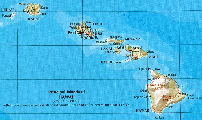
We'd be spending a week together exploring the Big Island, and then I would spend the day on Oahu before flying home, while the others would spend a few more days on the Big Island.
Day 0
I was able to take a couple of the exams the week before, which helped tremendously, but by the time I had to leave for SLC, I still had to take one more final. In fact, I had been so focused on other exams that I had not even read the material that would be on the exam yet! Ugh! :-( Luckily, this was an online exam and I still had 2 days left to take it...
The drive to SLC was (thankfully) uneventful, and I found a Super 8 near the airport with availability.
photo from 10best.com
The room was great, but the area seemed a bit sketchy. However, they'd let me leave my car there for $20 and shuttle me to to/from the airport. I was very technical in my decision making. Flip a coin! Heads - save money; tails - spend $100 in economic airport parking. Heads won.
The plan was to stay up and learn the material for the exam, and then take the exam from 3-5 am, before showering and leaving for the airport. I thought I'd be able to pull an "all nighter" and sleep on the plane. I ended up being too tired to study, but I couldn't sleep either, so I lay in bed trying to will myself to sleep until the 5 am wake up call - the worst of both worlds.
Day 1
The SLC airport had gorgeous snow covered mountains surrounding it. I didn't take a picture, but this one captures it well!
Photo from travelsaltlake.com

Flights for Alaska Airline were on time and I made it through the airport security with plenty of time to spare. This was my first experience with Alaska Airlines and they were great! The only thing that would have been better is if they would have had TV/movies you didn't have to pay for and food or real snacks for the 6 hour flight from WA to HI. But since I was just studying, it didn't matter.
I arrived in Seattle and started studying. Right across from me was an older, shorter version of Lukasz. I assumed this was his Dad, and when I saw him doing Polish word puzzles, I wanted so badly to go over there and talk with him.

But... I knew I wouldn't get any studying done and I REALLY had to learn the material before taking the final. LOL
I had booked my ticket so that I was sitting next to him, and finally introduced myself when we were took our seats on the plane. :-) I spent the first half of the flight studying and the second half chatting with Panie Władek.
Łukasz and Mary were flying the same time as us, even though they were leaving directly from Grand Junction.
We met Mary and Łukasz at the airport in Kona with real leis that smelled...much better than we did! Łukasz was our chauffeur and we were off to start our adventure!!! ALOHA!!!!!
Our first stop was to find the hotel. This proved much more difficult than expected! The GPS (which, unbeknownst to us at the time, would be a source of aggravation throughout the course of our journey) took us everywhere EXCEPT the Kona Islander Vacation Club Hotel. Finally, after a few loops around Kona, we asked for directions and found it just a block or two away...


Watching the sun go down never got old in Hawaii, but this as our first one, with a big cruise ship in the distance!!!


"Mamma always said: Life is like a box of chocolates. You never know what you're gonna get."

I will mention that our room had no air conditioning and one bed. It did, however, have 2 fans and a couch that pulled out into a double bed, so all was good. :-) Always an adventure! And the fun would begin tomorrow...
Day 2
The next morning we weren't in a rush and had a nice breakfast with coffee. We headed out to the Hula Daddy Coffee farm, where we started the day off with...MORE coffee (and much better than the hotel's coffee).

After sampling the coffee, we took a tour and learned how the famous Kona coffee is made!

They were right on the ocean, which was pretty neat. This was only one of the many places where they had coffee trees.


And now that the tour is over, it's time to sample their "special" coffee tea. (Weird, right?)

It was very hot, so we had to let it cool a little bit. Time to see what this "coffee tea" from Kona tastes like.

Not too bad. Let's have some more!!

What is in this stuff? Is the room spinning? Are we hallucinating? Are we in HI or CO? LOL

We DEFINITELY need to bring some of this back home!!! :-D
(Just kidding. Effects of a foggy camera lens...)
And here I am, entertaining myself with children's book in Hawaiian, :-) This is how to get me to wait "patiently" for the rest of the group to finish... LOL

But it was still cool to see how the trees were grown, how they deal with lava for soil (they had to drill two foot holes every single place where a tree would grow), how the coffee seeds were grown and picked, and then the process to turn it into the coffee we drink!

From the coffee farm, we drove to Kohanaiki Beach Park and set up camp. GPS was iffy and the phone lost power even while being charged. Mary was a lifesaver as she brought a solar powered phone charger that could be carried on hikes, in the car, etc. This allowed us to charge the phones most of the time (which was needed with all the photo taking (on my part at least) and trying to use GPS.
We found the park and Łukasz talked to the man in the straw hut to figure out the best place to set up our tents.

We were going to be camping tonight on the lava by the ocean! :-)


There were a number of other people who were also camping here, and many who were just here for the day to surf, swim, or relax and soak in the rays.
Once the tents were set up and held down with lava rocks in case the wind picked up, we headed off to Mauna Kea - the TALLEST mountain (even taller than Mount Everest) from base to summit at over 10,000 meters above the sea floor!!! So basically, not only have we summited Kilimanjaro, but I would now summit the tallest mountain on Earth! :-) Sweet!!!

Because we would be scuba diving and spending time at sea level, we intentionally put this at the front of the trip where we were better acclimated from Grand Junction and the long flights.
When we left the camp, it was hot and sunny, but about an hour later, by the time we hit Summit Drive and reached mile marker 28 at 6000 feet, it was so foggy and rainy that we opted against doing the Pu'uHuluhulu hike (yes, I CAN change the itinerary!). So, we continued driving another 6.4 miles until we reached the International Astronomy Visitor Center at 9200 feet, where it was still very foggy.

We spent some time acclimating here, checked the weather at the summit, watched a really cool summit film, checked out the gift shop (where I, of course, bought a thick fleece), and ate Subway sandwiches.


It was like hiking on mars. No vegetation - just lava rock and desert. The picture below shows the elevation we were climbing and how low the sun was getting already!

We had to move at a decent pace to ensure that we'd make it back to the jeep and up the rest of the way to the summit in time to watch the sunset. Not a lot of time as you can see, and it isn't as easy to hike quickly at 12-13K ft as at sea level, especially with about a 500' ascent, but we did it.
I love this first photo, because what looks like ocean waves behind the lake are the clouds that we were in between 6000 and 11,000 ft!


Władek, Łukasz' dad, was the only one coming from sea level (Chicago). The rest of us were from at least 4,500 ft in Grand Junction. Considering that, he did amazing!!!! And the best part? He had never been anywhere near this high before!!!!!
After this hike, we continued up the summit to where all of the observatories are. I had no idea how big astronomy was in HI, but this is where some of the largest telescopes are!!!


And of course, before sunset I wanted to reach the actual summit, which required a short hike. The summit is at 13,800 ft. I had no idea that the first (almost) 14'er I would climb this year wouldn't be in CO, but in HI!!! LOL And yes, there was snow up there! Good thing I bought my new fleece!!


That's right! I'm now on the summit of the tallest mountain on EARTH!!!

Mary saved the day again (and put up with my anxious mood) by letting me borrow her charger and it just got enough of a charge to get a few photos before the sun went down. It was beautiful up there, albeit a bit chilly!

This was a really cool cloud and sort of looks like an explosion among the clouds. The other thing that's pretty neat is how the clouds are now all under us and it looks like the sun is setting over the water.


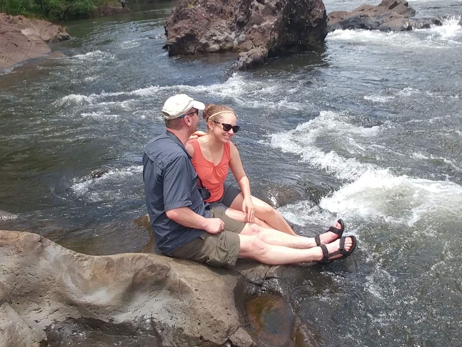
At least these two found a way to keep warm. :-)


Here's a cool picture from Łukasz' camera.


There, we watched more videos and learned a lot about the stars and that there
is a lot of evidence for a 9th planet (and not Pluto). I emailed my
Physics teacher and asked if he thought it was an appropriate senior level
research project to find planet nine. (I mean come on, how hard can it
be?)

Most days, they put out the telescopes and let people look at the stars, but due to the weather (even though it cleared up by the time we got down there), there was no stargazing that night. We were able to see a lot of stars from there with just our bare eyes, but not much else.
Did I mention it was freezing up there??? :-)
During the night, as would be another theme on this trip, it poured. Mary and I were using my sister's amazing Marmot tent and didn't get a drop of water on us. Unfortunately, the guys had a tent that leaked and they got a bit wet. I'm not sure what happened to the sun and the "no cloud in the sky" morning we had, but from that point forward, the clouds and rain followed us wherever we went!
Day 3
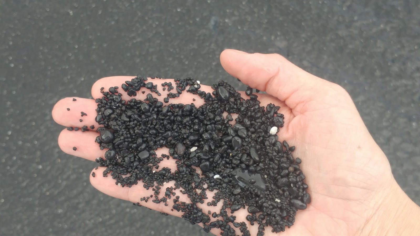
In the morning, we took down our camp. And I will say (with pride) that the two Mary's kick butt when it comes to getting ready in the mornings!!! :-D I went for a jog (more out of impatience than because I love running, and I had a lot of energy). About a mile up the coast, I found a string of lava rocks with really cool sea urchins (that move around when you touch them with a stick), crabs, hundreds of hermit crabs, and more! I came back and our group ended up spending about 30 minutes exploring this area before heading out from camp. Yes, we were behind schedule, but SOOOOO worth it!!! :-)
Example of one of the cool spiny sea urchins. These were everywhere in the water, which is why I swam or waded with shoes on!

There were many examples of exoskeletons of crabs who apparently were laying out on the lava rock sunbathing and got baked!

And lots of exploring to do!


What did you find???

Sweet! A crab!


And lots of hermit crabs in all sorts of shells moving around (I took video, but it didn't turn out).


Mary and Łukasz wanted beaches, and I wanted hiking, so... We combined both! Our first stop this morning was a 15 mile drive to Kiholo Bay. From there, we hiked southwest of the trailhead for about 1 mile and came upon flooded and empty lava tubes, lava cliffs with super cool crystals in them, turquoise lagoons that you could see from the cliff, a black sand beach made up of smooth black stones and a small pond surrounded by palm trees.


This is what the "sand" looks like close to the water. It does get under the sandals and hurts to walk (Mary had the best shoes on for this!)
This is one of the old lava tubes.

Collapsed as it doesn't go all the way through, but still like a cave and fun to play in.

And there were jumping crabs and even an eel that we saw!
Władek and I did some exploring up on the lava rock cliffs while Mary and Łukasz stayed on the beach and played in the water.


These are the crystals I was referring to earlier. They break like thin ice.

Rust colored rock as well and turquoise blue lagoons underneath.


This was a great beach to have privacy on! We basically had the beach to ourselves!!


We then hiked back toward the Jeep and continued on to the left side of the trailhead for about 3/4 of a mile. There were cool trees and coconuts to play with...


Who can resist climbing and playing in the trees? :-D

Hmmmm. What can I do with this coconut?

Posing for the camera with a sweet smile. No idea what the crazy girl to her right is contemplating... hehehe


This beach was by a golf course and had giant green sea turtles. We went snorkeling and watched them under water for awhile. Very cool! And as before, we were (basically) the only people on the beach! There were 2 guys who joined us, but that's it...

These underwater pictures are from a friend of Mary's who is a photographer (we didn't have underwater cameras), but you get the point... :-) It looked super cool underwater!!!!


This is the guy we named "Baxter" whom we saw in the shallow rocks on the hike back.

Kind of hard to kiss with snorkels on. LOL


Once we left the beach, we drove 35 minutes north to Puukohola Heiau National Historic Site. This wasn't terribly exciting, but was on the way and worth stopping at. part of the loop trail was closed, but the rest showed the largest heiau in HI. A heiau is a stone temple, and only those worshiping could go into the temple - not tourists.

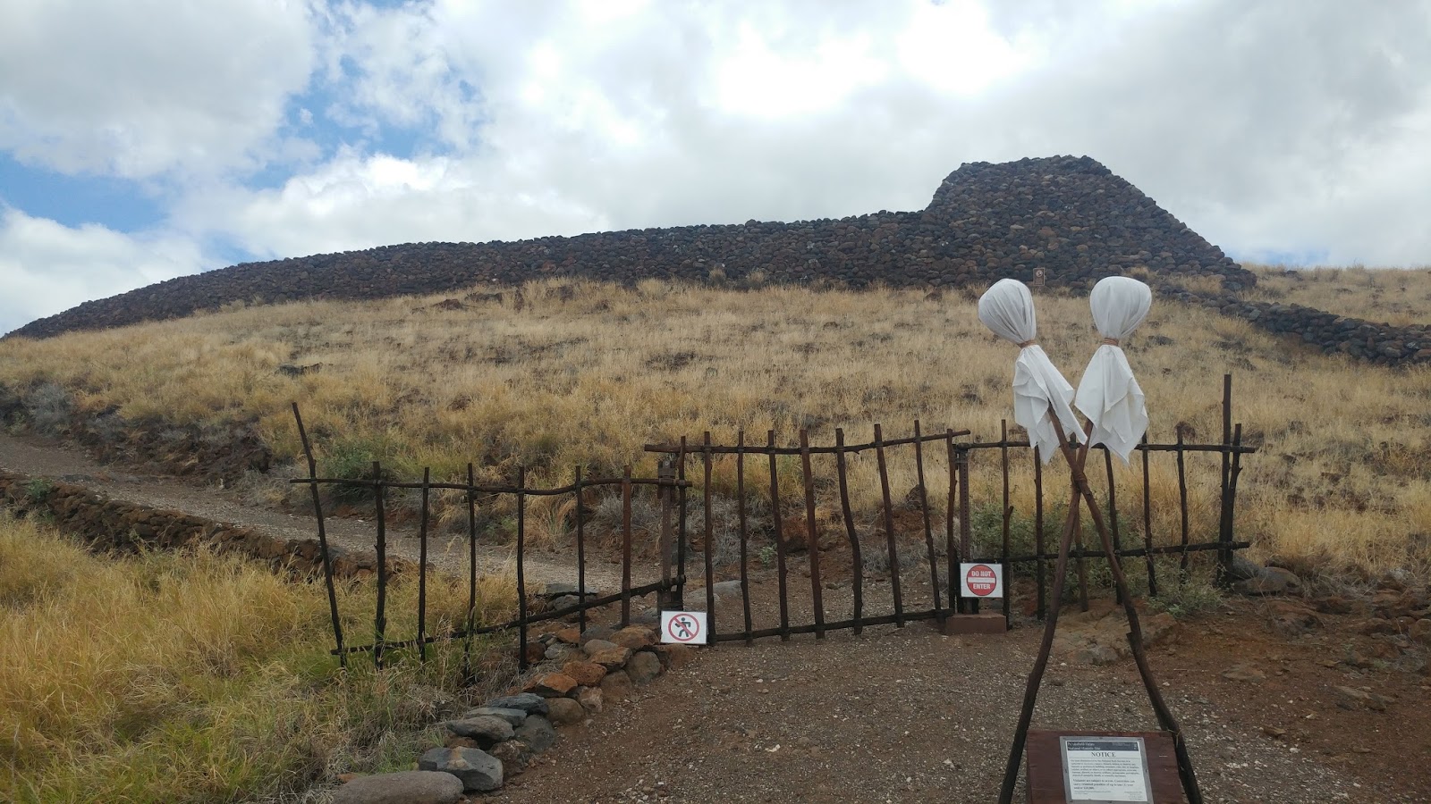

Also of note is that this bay usually has many shark swimming around in it. This is right by Spencer Beach (in fact, you can see Spencer Beach across the bay). However, we did not fit "swimming with sharks" in the itinerary. (Sorry guys!) And you couldn't see any fins above the surface - trust me, I looked!

From there, we continued driving 40 minutes to the most northern point of the Big Island and came to the Pololu Valley Overlook. It was VERY scenic, with dramatic cliffs, valleys with low hanging clouds, island outcroppings... One of my favorite spots on the island!!!

One of my favorite pictures (below). :-)


After taking a few pictures from the overlook, we hiked down to the beach. It was steep, but a nice, easy hike only about .75 miles one way in distance.


This was sort of a beach version of a child's playground with logs of rope swings and other things for kids to play and swing on.

It was super windy down here.

And there were TONS of caryns! (Never saw caryns at the beach before!!!) LOL


You can see the cliffs and small islands from the beach.


And then I offered the group an optional 3 mile round trip hike down to the end of the beach and then climb up the other side to see two other valleys and more cliffs. Everyone agreed!!!!! :-D
Władek led the way! Totally different scenery than the lava rocks we've been seeing. Lots of forest and tall grass with wild flowers, just as if we were hiking in CO!


There was a point where we had a clearing with wildflowers and then a slight downhill back into the forest. I thought we had somehow missed the overlook and was disappointed, but Władek and I decided that since we had nothing to do but wait for the other two to get here, we might as well keep going and check it out. Turns out that was just the last quarter mile of the hike and below are pictures from the overlook. Well worth the hike!!!!!


Since Władek and I were hiking at a different pace than the lovebirds, there was no shortage of Polish! I have to say as I type this that I'm missing those hikes and conversation. Łukasz has a pretty great dad! :-)


Before long, the rest of the group made their way to the top. I think we could have stayed up here for hours.

See Mary, I CAN relax!!! ;-) I think I will have to frame this and add it to the relaxing Brazil picture!


Mary and Łukasz have this thing about taking pictures of their feet. LOL I've taken a few pix of them taking pix of their feet. Kind of interesting, so I decided to include it in the blog. :-D


Flowers seen along the way back.

When we finished the hike and got back to the car, we were nice and sweaty (read that as smelly). LOL We took advantage of all the cuties (mini-oranges) and bottled water, and then headed to Hawi to sample their homemade ice cream. I had the blueberry cheesecake and it was AMAZING!!!! We also stopped for BBQ from a vendor near the shops (and not only had the last of their food as they were getting ready to shut down, but had to get creative to feed the vegetarian in our group... This was a quiet little town with a woodshop and other stores that catered to tourists. It reminded me very much of the small towns we'd stop at on our car cruises along Route 66, but there were no donkeys here.
With our bellies full, we headed to Spencer Beach Park to set up our tents. We made it just in time to watch the sun set over the water.

There was a large party going on, so I thought we were going to be kept up all night, but it was surprisingly quiet once we went to bed. (Either that or I was just exhausted.)

It was also SUPER windy (probably the most windy I've ever seen it outside of the hurricanes in FL) and so tying down the tent proved challenging. We couldn't get the stakes in due to the lava rock, so we used the largest rocks we could find, and then Łukasz helped by giving us 2 gallon water jugs to put in the corners of the inside of the tent. I was up for a while just waiting for us to blow along with the tent right into the ocean. Luckily, we survived the wind without incident and the morning was beautiful and peaceful.
Day 4
In the morning, we took down our camp and packed up. We had a busy day and so we didn't stick around to snorkel in the bay and try to find sharks. I'm happy that there have been showers each time we've camped, even if the water isn't very warm. With all the hiking we're doing, you would not see any of us close together in pictures if that wasn't the case! It can be warm at times here, depending on the wind and where we are, especially if you talk to any of the other members of our party. I tend to think it's cool or cold most of the time (though I can have goosebumps if it's < 85 degrees). It's also humid, which adds to the "smelliness".
But I digress... Today everyone (including Łukaszs!!) were ready to go ON TIME!!!!! We were actually slightly ahead of time per the itinerary, so we took time to stop and have breakfast sandwiches and coffee at a small cafe.
It's about a 75 minute drive to Waipi'o Valley, which is on the east side of all the cliffs that we saw yesterday (still at the northern tip of The Big Island). As with the last spot, there was also a gorgeous overlook at this end. This is one of the best views of the island and also is where some of Water World was shot!

And, like the other side, this one also allowed you to hike down (if you didn't have access to a true 4WD truck that could handle an average 28% slope and large potholes). The way down was brutal on the knees despite poles (for those of us with crappy knees). I normally love carrying the pack and always offer to as it slows me down, but about 1/2 way down my knees had sharp pain with each step and I just hoped it would be worth it...

I love this sign! :-D

So, this is a 6.5 mile round trip hike, which includes about 1 mile of hiking down to the bottom and then walking along the black sand beach to the high waterfall on the right and the cliffs and valley (with more tall waterfalls) to the left. The waterfalls only really can be seen after a lot of rain (lucky for us, we've had lots of rain and we got to see two of them).
You can sort of see the tall waterfall about 1/2 way into this photo. This is where I'll hike to later in the day...

And this was the river that came from the valleys that emptied into the river. We all had to cross this, which was fun!


Mary turning the sand into artwork with her feet. MJ right ahead of you. We look like twins!


It was warm out, the sand was soft, and the water cool. Perfect time to strip down to our swim suits and play in the waves!

This is as far as we could go to the left. We could also hike past some private property up a trail into the valley, but we were using up our water supply and clouds were low indicating possible rain.

This is a look back at where we came and as you can see, we almost had the entire stretch of beach to ourselves again!

There was a very nice looking local with blonde hair back in a ponytail who looked like a surfer that climbed up the tall palm tree to cut down coconuts in preparation for the 2:30 pm party they were going to have. Can you spot him up in the tree?


This is a view of the valley from the beach. You can't really see it from here, but the farthest from us in the center is a very high waterfall that was absolutely gorgeous! Hard to get a good photo though...

This picture from further along the hike is a little bit better...


Time to head back toward the main beach area that we first hiked down to.

On the way back, we found a large coconut and tried to crack it open on the rocks.

Luckily, we weren't relying on this for our food source (or I may not be around to type this blog).
I had wanted to hike across the rocks and see if I could reach the waterfall to the left. It didn't look "too" far away... No one else wanted to go with me as it was hot out and there wasn't a ton of water left (and we still had to hike back up that super steep cliff). I thought it would take 30 minutes total, but underestimated the distance and ended up rolling my ankle on rocks. The tide was coming in as well, and there were places I had to wait until the water finished crashing along the rocks to get through. But I made it there and back.
You can see the waterfall straight ahead in the middle of this photo, and what the rocks were like. Almost there!!!

The hike was very pretty. I wish the others had come along. They probably would have loved it as well!

And there it is. Even backing up to take a photo, I couldn't get a shot that went all the way to the top of the cliff.


The hike back up was actually much easier than the hike down...
This was a great way to start our morning! LOL Then it was time to say good-bye to the north and head down the east side of the Big Island (we're going in a counterclockwise direction around the island from Kona, but from the West, we explored Mauna Kea, which is in the middle, and from the East, we will explore the volcanoes).
On the way to Hilo, we stopped at Akaka Falls.

This was totally like being in a jungle and only a short hike to see the great waterfall.

Not bad, right? Almost 500 ft tall!!!!


This was supposed to be a .5 mile loop hike with both Akaka Falls and Kahuna Falls, but the trail to Kahuna Falls was closed.
Back by the cars, these roosters were just hanging out hoping us humans would feed them. There seemed to be a lot of roosters on the island as we heard their famous "cock-a-doodle-do", or as the Polish say "kukuryku"!

It was just about 6 pm and we still had sunlight, so we thought...why not see another waterfall before heading to our hotel?
We stopped by Rainbow Falls, which is on the way to Hilo (just outside of the city in fact). It's called Rainbow Falls, because you should be able to see a rainbow in the falls during the day. However, both times we went their (tonight and tomorrow), we saw no rainbow. Still, it's a very nice waterfall!

Now, the boys (that would be Władek and Łukasz) decided to stay up here and watch the waterfall, while Mary and I decided to hike through the trees and play in the boiling pots and rocks at the top of the waterfall. :-) It was SO much fun!!!!

These trees were my favorites! They had the most bizarre trunks and are called Banyan trees. You'll see more of them later...

So... We got to play on the rocks all the way up to the edge of the waterfall.


Here are some pictures I took. I tried to get as close as I could to the edge, but I have a slight fear of heights and a sore ankle that didn't feel great on these rocks, so I had to be very careful.


A selfie!!!! LOL This is as close as I was able to get to the edge of the waterfall. You can see it drop off the edge just behind me and to the left.


And the view from the hike back... This is like something out of a movie. Beautiful!!!

After this, we were all ready for dinner and bed. We found the Hilo Reeds Bay Hotel right before sunset and got settled in.

The past couple days we did a lot of hiking with elevation, but tomorrow would be a "free" day, meaning I left it open on the itinerary with some suggestions so we could do whatever we wanted - sleep in, go to the beach and relax, etc...
Today is Mother's Day!!! The downfall is that there were a lot of things closed (hence the "free" day) and restaurants were crowded. We woke up to rain and were all super hungry. Where to have breakfast? Mary googled breakfast places in Hilo and asked Łukasz if he was okay with IHOP (I love their pancakes) or if he wanted something different. We all decided after a week of local food to go with the familiar. It was pouring by the time we arrived and it was crowded. Happy Mother's Day!!!! :-)
We loaded up on sugar and caffeine, ate too much food, and then decided to go back to Rainbow Falls to see if we could see the rainbow. (And because the guys secretly wanted to play in the pot holes like we did yesterday. ;-) It was only a mile away, so why not?
Notice that there was no rainbow during the morning either.


This time, Łukasz and Mary played in the water and rocks, while Władek and I played with the rocks and trees in the forest.


Meanwhile, we were trying not to fall on the wet leaves and mud from the rain, and really enjoyed the forest!!! This is a Banyan tree root that formed around the rock/boulder.

And, you can see just how wild and large these trees really are.
This is another version of a "tree house".


Time to check in on these two and see what kind of trouble they are getting into...
What are you two doing???

Of course! Taking more pictures of your feet. :-)


It started raining again, so that was our cue to head on to the next place. We stopped by the Imiloa Astronomy Center.

There was a place showing how kids learned the ancient language.

And a section for the kiddos, two of whom you can see below. LOL

We had tickets to the 12 pm movie in the planetarium that would talk about the migration, connection of Polynesian people, constellations, and other HI astronomy. But before this, we donned 3D glasses and learned all about the solar system and rest of the universe.

Makes you feel really small and insignificant when you think about it!!!!! But both were very informative!!


Although this was a relaxing (and rainy) day, and even though we had a huge breakfast, we skipped lunch and were "starving" by the time it was about 4 pm. So... we found a Sumo wrestler place and stopped in to have another super large meal! (So much for the effects of the hikes!) But the food was awesome!!!

After further stuffing ourselves, we went to the farmers market, which was nearby, to load up on more fruit.

Łukasz' normal negotiating tactics weren't effective here as they don't really negotiate much, but we still walked out with plenty of goodies (fruit and gifts for the kids at the place across the street). We even got to witness our first (and last) HI arrest. LOL

After the farmers market, we went back to the hotel. We needed to get to bed early as we had to get up at very early (about 3:30 - 4:00 am) in time to drive 45 minutes southeast to get to the dock in time to board our small powerboat in the morning.
It was still early, so Władek and I decided to take a walk by the ocean and bay while the others napped. We encountered several serious downpours and ended up soaking wet by the time we returned. It was a lot of fun though!!! There was a lake with swans in it, so I learned all about "jezioro łabędzie" and its composer, "Pyotr Tchaikovsky" in Polish from Panie Władek. It was an enjoyable walk despite the rain.

Can you see the swans?

The clouds made the sky look like heaven was just up above them...

When we returned from our walk, Łukasz and Mary decided to stretch their legs and take a walk. When they returned, we set our alarms and went promptly to bed.
Day 6
The day began just a few hours after we left it. It was still dark out, because it was not even 4 am when we woke. We packed up and left, wishing some place was open for coffee this early, and headed down a really spooky narrow road that looked like it would dead end at any time in the middle of a forest. Finally, the road opened up and we arrived at the dock. We were early, so we ate muffins and put on our sandals and rain jackets. As you probably guessed by now, it was raining again. LOL Hilo is known for being very rainy, but it just happened to be the most rainy week while we were there. (Go figure.)
There were only 6 of us on the boat. We headed out on a very rocky journey for about 30 minutes as the sea was incredibly rough going over swells that tested the stomach. Don't get me wrong, it was a lot of fun, but my stomach (as I'm learning) isn't quite as strong as it once was!

Well worth the journey and price! This was really the only way you could see the molten lava flowing down the side of the volcano (actually the fire on top was from the heat of the lava in the lava tubes just below the surface). It came out as lava waterfalls, glowing red out the side of the mountain. What a gorgeous way to star the morning!!!


This is a gigantic sulfur and other poisonous, acidic gas cloud that we needed to stay up wind from and avoid or it would burn holes right through us like battery acid.


I love this photo as it shows the amount of lava pouring out (and this extends across the cliff). It's like molten lava waterfalls!

Here is a video:
And just a little further down, there were ongoing explosions. Some got rather close to our boat, but luckily, no fire rocks landed that close to us... It did feel like being by a bonfire though!

Video of the explosions:
You can see another small boat underneath the poisonous gas cloud. Too close for comfort!

And these are flying lava rocks from another explosion. Pretty close to us!!

And even more explosions!!!
It looks like the ocean is on fire in this picture, and you can also see how high the waves were.

With the rain, there were areas where the sunrise let light through. Beautiful!!! This is looking back toward where we came from when it was time to start heading back.

And, we were blessed to have a rainbow over the fiery rock and water!

On the way back, when we had more light, our guide spent some time talking about the different lava flows that created the cliff and rocks on that side of the island.
Waking up at 3:30 am means by sunrise it's practically nap time!!


We drove to the city of Volcano and had breakfast and some much needed coffee. Then we continued on to the national park. Łukasz had a national park pass, so we got in for free! :-)
At the Visitor Center, we learned about what was open, where we could go, etc. We stopped to use the rest room and then drove to the Jaggar Museum, where we spent some time viewing the active crater (where you can only see a little bit of fire coming up).


This was a rather full day with hikes, scenic drives, etc, so... I did not anticipate spending a couple hours at the Jaggar Museum. I should have. LOL Here's Mary teaching us about the lava rocks.

This is from an image - not real life (below).

And... Łukasz was totally in his element listening to all the ranger talks. This ranger was like a squirrel on a caffeine high! OMG! She was great, but had waaaaay too much energy for me. (Perfect for what she does.)
So, while waiting while the ranger talk continued, I wandered and enjoyed this image. Can you imagine getting this close?

Then Mary and I found this and decided to jump and see how great of an "earthquake" we could make!

And this is Pele the goddess of the volcano!

From the museum, we drove to the steam vents. Mary and Łukasz weren't too fond of the pouring rain and opted to stay in the car and take a nap. His dad and I braved the elements and went for a 1 mile hike to see the steam vents, steaming bluff, and Sulfur banks.


As you can see, we are tough and don't mind a little rain!!! Unfortunately, my phone is not so tough and is 1/2 broken now from the pouring rain, despite being in my pockets...most of the time.


Our last stop on this short hike was to the Kilaueu Overlook, which was a crater and large valley full of steam that looked like a sauna. Mixed with the fog from the rain, it was hard to tell what was what. LOL


It took about 20-30 minutes to see everything. We then went back in the car and continued on to the Kilaueuiki Overlook, which is where Mary and Łukasz dropped his dad and I off to do a 4 mile hike into the crater.
Ever the nurse, Mary had an emesis bag on her, which she used for snacks to ensure we didn't go hungry. :-)

They continued on and drove to the Thurston lava tubes, which is where we would end up. We went at a decent pace despite the rain and slippery rock and completed the hike in 1.25 hrs.


This is what it looked like once we hiked down into the crater.

We ended up at Thurston lava cave. Our timing wasn't the greatest as there was a bus full of people with umbrellas from a convention who all were in "line" ahead of us, moving through at a snail's pace.
This is the entrance to the lava tube. You can see how large it is!!!!

And from the inside.

After that, we took the scenic Chain of Craters drive, and there were a ton of craters along the way. We didn't stop at all of them, but here are a few:


Yes, it was a little bit windy! :-D


There are over 23,000 petroglyphs here. Of those, 16,000 are pika (the holes discussed further below).


So what's with all the little holes that were carved out of the lava? Well, the people who had ties to this land came here to place the "piko" (HI word for umbilical cord) of their child - the piko are the holes. They hoped that by doing this, the spiritual energy of Pu'uloa (which is where these petroglyphs got their name) would bless their children and give them long, healthy lives.


I love this picture because I can just hear her thoughts... "I'm cold and wet, and we haven't eaten since breakfast. Not to mention, you got us up at 3:30 am. Now you want us to hike again? When in the itinerary is food and sleep???" :-)


When we finished hiking back we were getting a bit hungry. Okay, Mary and I (mostly "I") consumed almost all of the snacks that were just purchased for the rest of the trip along the drive. But "snacks" aren't the same as a meal. Besides, all this hiking and rain makes one want to eat!!!! :-)
There was one more stop before going to the ocean. Interesting landscape!


At the ocean my phone was dead, so there aren't many pictures to show. However, there is a 10 mile hike along the lava rocks to see (if you're lucky) a little bit of the smoke and maybe some of the lava that we saw this morning. According to those who did the entire 10 miles in the heat - they saw nothing and it wasn't worth it. Lucky for them, they had the lava boat ride planned for the next day, so they would get to see it after all!
There was also a pretty neat arch made out of the lav rock.

We had plenty of time before sunset, so we decided to stop at a Thai restaurant for dinner and picked up the key to the house where we were staying in Volcano. At the restaurant, Władek ordered a special iced tea that came with a flower. He let us all sample it and it was incredible!!!!

After dinner, we headed back to the national park to return to our first overlook of the active crater by Jagger Museum. You could only see smoke during the day, but at night, the red from the fire below showed through the smoke. The only downfall is that it was not only pouring out, but freezing cold as we were at a much higher elevation than when at sea level! Brrrrr.

There was no heat at the house where we rented a room, and my shoes were wet, disgusting, and smelled incredible from hiking all day in the rain. I tried to wash out the insoles and shoes themselves, and then dry them, but the smell persisted and I got yelled at for putting shoes in the dryer. Too bad we had to put them back in the car the next morning. :-(
Day 7
Two days ago we were at the northern tip of the island and today we will be at the southern tip. We woke up and had oatmeal with mango for breakfast, and...instant coffee. My body had become accustomed to Kona Coffee, pancakes swimming in syrup, and overstuffed omelets. Way too healthy!!! LOL
While eating this nutritious meal, I saw something flash by the window that looked like an overgrown bird with a busted wing trying to fly. I almost spit instant coffee out of my nose when I did a double take and saw it was our very own Łukasz doing his morning "exercises". LOL If only I could have gotten that on video... :-D
It didn't take long to clean up, pack up, and head out toward Punalu'u Black Sand Beach, which is known for their giant sea turtles.
We actually didn't have to hike into this beach and there were lots of sea turtles hanging out on the beach, just minding their own business.
This one looks annoyed.


I wonder if they have names. I named the other one Baxter. The first thing that came to mind with these 4 are... Matthew, Mark, Luke, and John.

This guy looks comfy.


These are the 2 sunbathing turtles by our picnic table. We did swim a little bit, and then hiked around to find some small abandoned native huts, broken bridges, and some rare openings through the forest that exposed all the peaks of the island.

And I cannot resist poking fun at my good friend. "My name is Łukasz. I'm so tired. Please, go swim and just let me sleep. 2 minutes. That's all I need..." LOL

It honestly wasn't the greatest from a "beach" standpoint as it was a bit on the rocky side for swimming and had sea urchins (so you had to wear shoes/sandals) and high waves in shallow water (making it difficult to snorkel). But the turtles were definitely worth the stop.
From here, we drove 40 minutes to the southern tip of the island, where we'd be hiking 3 miles each way in the middle of the day with heat and humidity...and no shade...to reach Papakolea Green Sand Beach. Knowing it would be hot and that we may want to stay for a while, I filled my hiking bag with 2.5 L of fluids/person, some snacks, and extra sunscreen.
Of course I planned to carry the heavy bag since I tend to hike faster than most people and it would slow me down a little and make me feel like I was getting a workout in. However, one of my favorite lines from Łukasz on the trip was... "So MJ, if you want to lose weight and get in better shape, you may want to carry the bag." :-D
Here's Mary looking girly hiking in a dress...and hiking boots! :-) And she's carrying her own pack as well...

So, why hike in the hot humid weather when there are millions of other beaches around? Well... This is one of only 4 green beaches in the world, and the ONLY one in the US. The green sand is more olive in color and comes from the collapsed "cinder cone" surrounding it.

I love this picture and it's not common to see myself giving someone a hug!

We didn't have the beach to ourselves as people can now pay $15-$20 to have someone drive them there and back. But in my opinion, with a little water and not moving too quickly, it was the perfect hike and well worth it!

Along the way, you get to watch the waves crash up against the shore and view the beautiful lava rocks and turquoise, blue, and green swirls in the shallow ocean water.

Then you get to climb down into the center of this steep little secluded beach and just enjoy the smooth sand, waves that are strong enough with the steep decline to suck a person away from the safety of the shore and into the ocean.

So, when you have to go to the bathroom and there's nothing around (literally) for miles, what do you do? Attempt to pee in the ocean! Normally, this isn't a big deal, but because it was so steep, each time a wave came in, it covered us, and then sucked all the water away, so you only had a few seconds at a time to go (if you want to pee in the actual water). To overcome this, I tried to stay down on my knees when the wave went away, but the water pushed me forward and slid my knees through the sandpaper-like sand rather quickly, leaving 2 bloody knees. Lesson learned... LOL

This short video just sums up the green sand beach.
The hike back was not so bad. We hiked at our own pace and were still a little bit wet, which kept us cooler than on the way in. One thing that was hilarious was the amount of sand that stuck to us and filled all pockets of our shorts, swimsuits, shoes, etc. The force of the waves churned up all the sand, so you couldn't rinse (or risk just getting more sandy). The dried salt also leaves a mark.

We left there and headed toward Miloli Beach park to set up camp. We were all very hungry (and cranky) from hiking and spending the day in the heat, so we tried to find a restaurant along the way. You'd think there'd be something as it was an hour drive! But no, the one place along the way that said it was a restaurant ended up being ... nothing, so we backtracked and spent another 20 minutes until we found a nice place.
So there's one more thing I have to mention... Łukasz's famous parking style. :-D When he pulled into the parking lot of the restaurant, he (being quite serious) said, "I think this is the best parking job I've done on the trip!" Mary and I just looked at each other and smiled. While that may be true, they apparently don't teach how to drive between 2 lines in medical school. LOL I couldn't resist taking a picture of the proud doctor and his awesome parking!!!

After the meal, we headed toward Miloli'i Beach Park. The road to get there was narrow, full of large water puddles from all the rain, and quite creepy. It was dark out and difficult to see, and as we approached the "beach park", we passed what didn't look like such a great neighborhood (the usual graffiti, boarded up windows, trash in the yards, etc). Red flags went up. The park didn't really look like a park. There was an empty parking lot next to a basketball court and 2 guys doing something in the pitch dark on the courts (probably a drug deal). There were no others cars or tents around and we didn't see any camp site. I made it clear to our group that I wasn't comfortable camping here and, as if right on cue, while we were stopped and talking about it, someone with a flashlight came up to the window to ask if we needed help. We quickly took off and drove straight to Kona, where we found a nice hotel at a decent price to sleep.
When we got to the hotel, I Googled reviews of the place and they talk about drugs, slums, etc. In fact, one mentioned that their waiter told them "Even Dog the Bounty Hunter doesn't stay in Miloli'i after dark!"
The good news? We could sleep in that morning as our first item on the itinerary wasn't until 9 am and we were already in Kona!! :-)
Day 8
This was my last day in Kona and my last day on the Big Island, and it was pretty open as far as whatever people wanted to do. The first order of business was coffee. The hotel only allowed breakfast for 2 based on our room and there were 4 of us, so... Władek and I headed to breakfast as we were the first 2 ready to go, and whenever the b-fast monitor (who watched us like a hawk) would turn around, I grabbed coffee and whatever other b-fast foods I could find, and brought them to Łukasz and Mary in the room. What a fun start to the morning!!! :-)
Our first destination was the Original Hawaii Chocolate Farm and Factory. We had coffee in the gift shop and I bought some chocolates to have shipped home.
The tour started with samples. Yummy! (Even though I don't like chocolate.)

Then we went through the "farm" and learned about the different types of cocoa trees and how to know when the seed pods are ready to be picked. These all have to be done by hand.

One of the first things he pointed out, is that cocaine does NOT come from cocoa trees - it comes from the coca plant. (One time he caught someone eating the leaves from the plant, and when he asked why they were doing that, the guy said he heard you hallucinate from just the leaves! Tourists...)

So, you have to wait until they are ready. They start out as just a tiny bud (see below) and can come from branches or the trunk.

When they get larger, they could be red or green, depending on the type of tree.

They are ready to be "plucked" when the pods are either gold, orange, or burgundy. So, if you see someone walking around with a machete, he's probably just looking for ripe pods to pluck. ;-) This one looks about ready!

About a week after harvesting the pods, you open the pod and get a group of beans inside a white gooey looking thing (that looks like an ice cream cone). These are called "wet beans". One pod has only 30-50 beans, and you need a lot more than that just for one of those 3 oz pieces of chocolate I bought!
Just a note that white chocolate isn't really chocolate and doesn't use the beans. It uses cocoa butter - other parts of this pod, which they don't have at ALL on the Big Island, so there is NO place on the island that makes (or sells) white chocolate! (Such as shame, as that's the only kind of "chocolate" that I like. :-(

I forget the name of this disgusting looking thing that he's holding below, but some people actually eat that! Not me!!

So... Once the white, wet beans are free from the pod, they are stored in those wooden crates to undergo natural fermentation. This process can take another week, but in the end, the wet, white beans turn brown.

Next, the seeds are put in these large trays and left out for another week in the sun to dry.


Then we moved from the farm to the factory part of the tour and learned how these silver machines turn the beans into the chocolate that we (almost all of us) love!
The beans are separated into cocoa butter and chocolate. To do this, you first have to remove the husk (the shell around the bean), which is called "winnowing". If you don't do this right, the chocolate tastes very bitter. What's left is called "nib". You may have heard of roasted nibs, which you can sell and eat.

Then the roasted nib is heated/melted, and sugar (and milk for milk chocolate) are added and blended. Then, the last step is the cooling process called tempering, where the chocolate is put in these holding tanks (see below) and that's where the flavor comes out. By stirring it slowly and lowering the temp from 120 degrees to 86, the cocoa butter changes its molecular configuration and gives the chocolate that satiny sheen.

When done, it's put into molds and cooled until it solidifies. And then it's packaged and we buy it and eat it!! :-D

After the chocolate factory, we headed to Pu'uhonua o Honaunau National Historical Park. We would only have 30 minutes to spend here if we wanted to make the next bee farm tour, so staying on schedule would be strictly enforced! LOL
We really didn't need more time that than, and it turned out perfectly! Łukasz watched the 30 minute film on the life of these people and the rest of us walked around and toured the sites. This is the sacred site of Pu'uhonua, which is a place of refuge, and the royal grounds. Although they are geographically close to each other, they are very different.

The start of this short hike is through the royal grounds. First, we come upon a game that looked like a checker's board, so Władek and I started to play. :-) It's called Konane and is a game of strategy w/black and white pebbles on a papamu (the stone game board).
This is a tree mold that is made when super hot lava surrounds a living tree. The tree is full of moisture (a fact that many of us learned by trying to start a fire with live tree branches). This moisture causes the hot lava to harden before it burns. A lot of the tree molds in HI are from palms, such as the loulu, which used to be very abundant back in the day of these royal grounds, but are not too common today.

This marks the spot where there is a protected cove and only the chiefs were allowed to land their canoes here.

They built this "Great Wall", which is 12 ft tall, 18 ft wide, and almost 1000 ft long! It was build to separate the Pu'uhonua from the royal grounds and was built over 400 years ago.

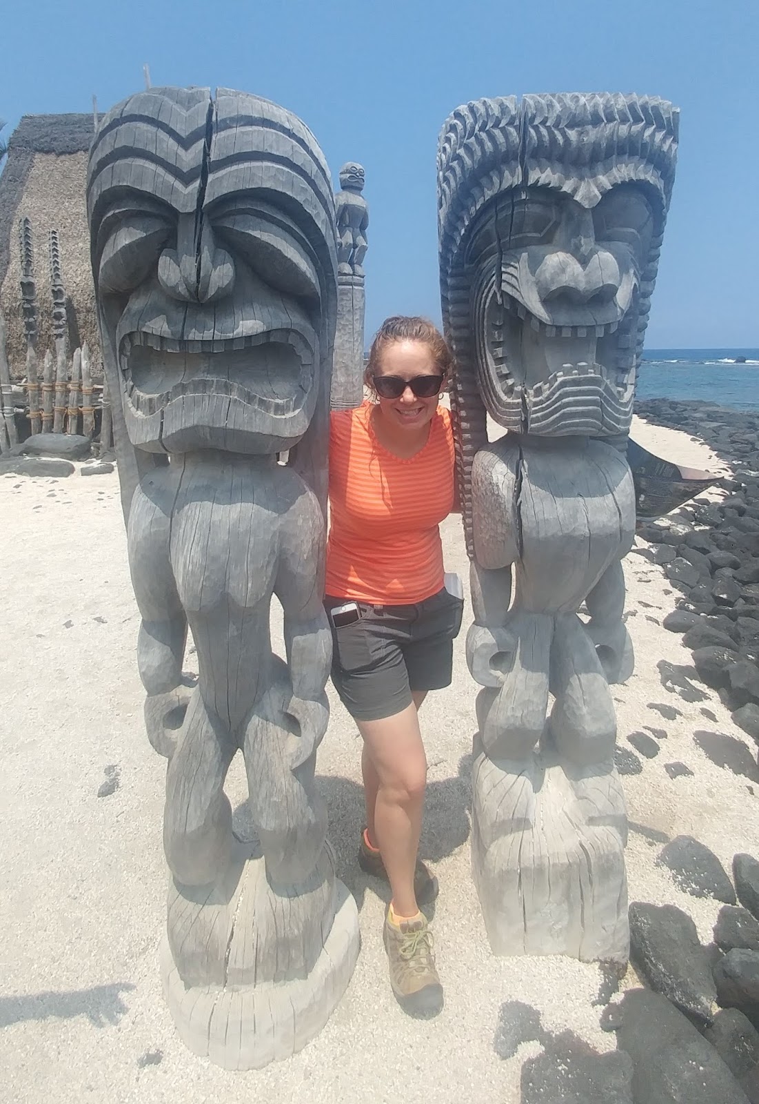
These items now are from the Pu'uhonua side... Mary's wooden escorts below are known as ki'i, and represent Hawaiian gods.

This is the "Hale o Keawe", which is a heiau that served as a royal mausoleum to hold the bones from the chiefs. Hawaiians consider this place holy/sacred and sometimes leave offerings on the tower.


Pu'uhonua is known as a place of refuge. There were a lot of laws (called "kapu") that we may find odd, such as women not being allowed to eat with men, or catching a fish out of season. However, if you were to break one of these laws, you would face the punishment of death. Extreme? Perhaps, but that's life (or death).

If you wanted to survive, you had to run faster than your pursuer, get to the coast, and then swim through the sharp lava rock, strong currents and waves, and make it to the Pu'uhonua side. (Reminds me of Alcatraz in a way.) If (and that's a bit if, since most people didn't survive) you made it, a priest could absolve you.

This large rock is called the "Keoua Stone" and was a favorite resting place of the high chief (named Keoua). The holes in the lava that surround the base of the stone probably were for a coconut leaf canopy to fit into.

And last but not least are the royal fish ponds, which held fish to be eaten by the chiefs. This is once again part of the royal grounds rather than the Pu'uhonua.

On the way back, were these shaded straw tents that held different tools and objects of the time. This one was used for making canoes, for instance.

And here is what Łukasz was up to. When we returned (right at the 30 minute mark!), he told us all about how people were killed for small infractions, and to avoid that, they would have to escape by swimming in the ocean.

We browsed the shop while waiting for the tour to start.


I had to buy some honey (of course) and while looking at the selection, we saw a baby lizard.


There were all sorts of things related to bee keeping in the store as well.

And, there was an enclosed bee hive for demo that led to outside (so the bees could come and go as they pleased). I was entertained by a child while we waited for the tour to start. :-)
They started the tour with a short video, where it talks about the 3 different places they move the bees to throughout the year, and the trees whose flowers they pollinate are the reason the honey is so different from each area. For those of you who I gave the 3 honey samples to, these are the 3 places - one had macadamia nut trees, etc...
After viewing the video and having honey tea and honey muffins, we went outside and were given something to munch on (I think it had to do with the macadamia nut trees, but I'm not sure).

Meanwhile, our tour guide, in sandals, shorts, and short sleeves, proceeded to go into the area with all the bees. Brave!!
So, there are 12 stacks of crates that all have a ton of bees in them. She asked us to guess how many bees we thought were in each. I guessed 4000. Nope! Then Mary said "40,000". I was like, yeah right! And that was the correct answer!!!! Way to go Mary! :-)

Then I started thinking... If there are 12 sets of crates, with 40,000 bees in each, that's almost 500,000 bees!!! Yikes!! Although there's a screen in front of us to block the bees, the top and sides are all open and we could easily get stung.

Our guide mentioned that the most she's ever gotten stung in one day is 20 times and the most the owner has been stung in a DAY is about 100!!!! Apparently you build up an immune response the more you get stung. (I don't care to test this out.)
So, after removing the lid to one of the crates, she used smoke to move some of the bees below. This helps them keep from getting stung.

Then she started taking out the different slates and explaining to us the difference between each and what the role of each bee is (male vs female, how one becomes the queen, etc.

This lizard wanted to participate in the tour as well.


Here are a couple of short videos from the tour that are more fun to watch than just looking at the pictures.
This video looks at the "bee glue" that holds the container together that she has to pry open. This is something the bees make (also known as propolis), and the video talks briefly about what you can use propolis for.
This video talks about royal jelly and eternal youth. :-)
And this video looks at the baby bees.
After this, we decided to get something to eat and get the keys to where we'd be staying tonight. I had been getting more and more cranky (bordering on "mega beast") as the day went on, and I think we could all use food (food makes everything better). :-) So... Seeing as we were back in Kona, we went back to Bubba Gump Shrimp and had a nice (and very large) meal with a tall, cold beer. Ahhhhh. Much better!
From there, Władek was going to hang around and shop and enjoy Kona by foot, and then walk back to the house. Mary and Łukasz had two scuba dives, and I had nothing until the night dive, so I dropped them off and went shopping and swam by the coral reefs. Finally, it was time to do the night snorkel.

I'd be in the same place as the other guys (for their 2nd dive), but I'd be on top of the water looking down and they'd be on the bottom looking up. LOL We all had lights. These lights attract the plankton and the manta ray eat the plankton, so they come to the light (usually). These are not our photos, but what we looked like (snorkeling) and what the manta ray would have looked like (had we seen one):
Source: getyourguide.com

source: tinyhousegiantjourney.com

This was the night manta ray dive and I was super excited!!!

We took the boat out there at sunset and watched the sun go down.

I love this picture! This is a double rainbow on the other boat out there that Mary and Lukasz were on!


When it was finally time to put on our wet suits, I was already freezing cold and sick to my stomach (probably from the food and beer, even though that was a few hours ago). I met Deena, one of Mary's friends and we had a nice chat.

Finally it was time to go. The scuba divers went first and then the snorkelers.

I snorkeled, which meant doing nothing but holding on to a bar and watching the fish below (and scuba divers) while waiting and hoping for a manta ray to show up. I was not only very cold, but trying not to throw up as I was very sick to my stomach. And after all that, we did not see any manta rays. :-( That was very disappointing, and we also didn't get our money back. However, we did see a large eel and watch a man propose underwater to his girl. She said yes. :-)
I just can't resist! One more picture of Lukasz' famous parking jobs. LOL

After showering, I spent more time than expected online revising my itinerary for tomorrow, and ended up not getting much sleep (and keeping Mary up).
Day 9
My last day in Hawaii and it would be a full one! Łukasz was kind enough to wake up at 3:30 am and drive me to the airport. Knowing how much he values his sleep, I owe him a HUGE thanks!!! I said good-bye to everyone and headed to the airport to fly to Oahu.
Once in Oahu, I rented a car and drove to Pearl Harbor to get a ticket for the boat ride to the memorial. They were already sold out for a few hours and I didn't want to wait, so I picked up a ticket and then drove south to Diamond Head State Monument.

This is Diamond Head crater. It's a very short hike up, but because it is sooooo crowded, and there's really no room to pass, it took forever!!!! Good thing I am so incredibly patient! :-D The other thing that was "fun", was that there were only about 20 parking spots and about 10 times that amount of cars, so I had to park about 1.5 miles away. That was fine, because I jogged there and back, which helped make up for the crowds.

Some facts about the crater. It's called a "tuff cone" and was created by an explosive eruption 150,000 yrs ago. It's 760 ft high and there used to be 5 heiau (temples for worship) on or around the crater. These temples were dedicated to the god of the wind as protection against strong updrafts that could put out the fires used by ancient Hawaiians for navigation.

The view from the top was beautiful!!! It was odd to see the tall buildings and downtown that reminded me of a large city and then see the ocean and mountains around it...

This may not look crowded to you, but there were mostly places that were single file and you had to wait for others in the other direction or you were not able to pass. Most people came in groups that didn't move quickly and weren't great about letting others pass. But there was a lot to see during the hike, which made it okay to go slower. LOL

Yes, we got rained on at the end. :-) The rain must have followed me from The Big Island!

In one area, we had to climb up a narrow spiral staircase. This is the view from underneath looking up.

And, there was a tunnel to go through.

All in all, it was a fun start to the morning! And now it was time to jog back to the car and drive back to Pearl Harbor.

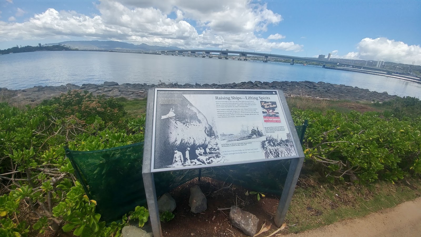
At the Visitor's Center, I bought a ticket for the Bowfin submarine and the self-guided tour of the Missouri (on Ford Island) in addition to the 12 pm boat ticket I already had to the USS Arizona Memorial. I had about 30 minutes, which was plenty of time to walk around and see the USS Bowfin.
The first thing I saw was the Waterfront Memorial. In this picture, you can see some of the individual memorial stones and the USS Bowfin in the background.

The Waterfront Memorial is a tribute to the 52 US submarines and more than 3,500 submariners who died for their nation during WWII.

The 52 monuments that you see around the circle, chronicle the wartime career of each of the 52 submarines lost. It also lists the names of those who died in the vessel. There's another monument there that lists the names of those who died, even though their vessel didn't sink.

This is the USS Bowfin, also known as the Pearl Harbor "Avenger".

It took a 2 minute self-guided tour through the different compartments of the submarine.

The bunks were either stacked 3 high or even 4 high!!! Not much room, but you could fit a lot of people that way into a small space. Being claustrophobic and afraid of suffocating, I had a hard time with the tour and you couldn't pay me enough to go in one and be confined for long periods of time underwater!!!

There were a whole lot of keys for one submarine!!!

So what's the story of the USS Bowfin? In short, it was launched one year after the attack on Pearl Harbor, on 12/7/42, and earned its nickname by sinking 44 enemy ships during the course of her nine war patrols!

There were lots of large torpedoes that made it possible to destroy so many ships.


There were also a lot of outdoor exhibits tracing submarine weaponry all the way from primitive torpedoes to the latest cruise missiles.

This is an example of the Kaiten, a WWII Japanese suicide torpedo. The name "Kaiten" means "to make a radical reverse in the course of events," which is what the Japanese hoped this secret weapon would do during WWII. It's basically an enlarged torpedo with a cockpit, periscope, and manual controls for steering, speed, and depth. It could be detonated on impact or by an electrical switch controlled by the pilot. There was an upper hatch that could be used as an escape device for the pilot, but they never used it. Over 96 Kaiten pilots died, and only 1 US Navy ship was sunk by the Kaiten!


The attack on Pearl Harbor happened on a Sunday morning and was part of Japan's bold opening move to achieve its territorial ambitions. The strategy was to cripple the US Pacific Fleet long enough to allow them to occupy much of the Pacific and Southeast Asia (like where Lisa is living). The day following the attack, Japan attacked Hong Kong, the Philippines, and Malaya.

There were memorials like this and like the one shown earlier along the walk for those who died during the attack.

The morning of December 7, 1941, just before 8 am on that Sunday morning, many of the sailors on the navy vessels in Pearl Harbor were getting ready for leave and preparing church services. In a few minutes the colors would be raised on 185+ Navy ships throughout the Harbor. On Ford Island and around Oahu, soldiers, Marines, and sailors at Army and Marine airfields and air stations were going through similar military routines.
There was virtually no warning. Pearl Harbor had detected all of the Japanese planes when they were about 30 minutes out, but after announcing it, the navy said to ignore it because they thought they were the US training planes, which were expected to return today. Other than that, there was basically no warning.

The attack happened in 2 waves. In the first wave, explosions shattered the Sunday morning calm. Japanese planes first attacked the airfields to destroy aircraft still on the ground. Then, they converged on Pearl Harbor. Dive-bombers dove quickly and damaged the seaplane base left of Ford Island. Then on the other side of the island, torpedo bombers attacked the USS Utah and struck what's known as "Battleship Row" (they struck West Virginia, Oklahoma, California, and Nevada, along with other ships). Bombers then stormed in in order to bomb the ships that these torpedoes couldn't reach. One of them detonated the USS Arizona and the ship exploded in a large fireball.
In just a few minutes, the attackers had changed things from being a quiet Sunday into a nightmare of huge explosions with black smoke and fire, and men were leaping from the burning, sinking ships (those that could get out) into the oil-burning water. All bases on Oahu were attacked at the same time - not just Pearl Harbor. The intent by the Japanese was to disable the planes on the ground, preventing airborne resistance to their main attack. There were citizens who also lost their life in the city from stray shells that landed in the city.

As if that wasn't enough, there was a second wave which happened 30 minutes later. At this point, like an angry swarm of bees, the Japanese pilots now had fierce resistance from whoever was able to help at Pearl Harbor and on the island. Antiaircraft fire filled the sky and the US shot 20 planes out of the sky. They also had sunk a midget sub that had slipped into t eh harbor earlier that morning. Despite that, the Japanese continued to use bombers on the airfields and their divers struck more ships and fighter planes still on the ground making it difficult for the US to defend themselves.
The attack ended about 2 hours after it started and the Japanese had destroyed / severely damaged 21 vessels and 300+ planes. Over 3,500 people were either dead or wounded.

After the walk, I went into a few of the museums and read a lot about what happened that day and in the following years. I can't believe how much I didn't know!!!


Finally, it was noon and time to go watch the video, further describing what happened that day, and then we boarded a small boat and went over to the USS Arizona Memorial. In the picture below, from the boat, you can see the USS Missouri on the left (which I will tour in about an hour from Ford Island) and the USS Arizona Memorial on the right.

The USS Arizona Memorial was built over the sunken hull.

It honors 1,177 crewmen who died aboard it during the attack.

The hull at the bottom of the ocean below this memorial is a tomb for over 900 sailors who remain within it. It is also a reef where many marine life live.

There's a place on the memorial where you can look down and see the hull of the USS Arizona.

Then at the far corner are the names of all of those who died on the ship.

Looking up from inside the memorial, you can see the American flag. I know we are all there as tourists, to take pictures and enjoy the sites, but it's really sad when you think about all the lives lost, and what this particular site represents.

When the boat returned from the memorial, I boarded a bus and went to Ford Island, where I was able to tour the USS Missouri.


In the command center... "Fire!!!" :-)

4 bunks high! Wow!!


After leaving the USS Missouri, I took the bus back to the main Visitor's Center and got back in my car to head north to the Dole Pineapple Plantation. I had a tour of the pineapple express and timed it perfectly, so I got there 5 minutes before the train left! :-D I was actually the last person on the train, and only got on that one because I was "single". LOL
This was a 30 minute tour by train of the plantation and was a lot of fun!!


This was the pineapple garden area.

They grow a lot more than pineapple.

Including bananas!!!


We got to see pineapple through all stages, from just a dirt field to the ready-to-be-picked pineapple.

And more cocoa trees!


Lots of stuff from Samoa (the street we live on). :-D

They even had a solar farm!


From the Dole Pineapple plantation, I stopped by McDonald's to grab a quick bite for the road as I was behind schedule. They served pineapple chunks with all their meals! :-D
While filling up on a not-so-healthy late brunch, I drove to the Polynesian Cultural Center. It wasn't that far, but I had to take the road that goes around the island. There were constant beaches (Mary would had LOVED it!!) but that meant waiting for surfers and others to pull out and lots of traffic jams waiting for people to turn, etc. It felt like it took forever to get there!

"Talofa!" That is the Samoan greeting, and the first village where I stopped. My first impression was how big all of the Samoan guys were! LOL I watched a musical show to start out.

I also got to watch the kids learn how to start a fire by rubbing sticks together, similar to how they start fire in the African bushman tribe. :-)

This is what their weapons look like.

Samoa is actually made up of Western Samoa and American Samoa - the only US territory south of the equator, and they consist of 5 volcanic islands and 2 smaller "American" coral atolls. Here's an example of their wooden boats.

Samoans have been on the island for ~3000 years. The heads of the extended households are called chiefs, and they are known for their tattoos, stylistic oratory, elaborate feasting, and special rituals.

The next Polynesian island I visited was Aotearoa (New Zealand). These are some of the art they create through weaving, etc.


They had an authentic meeting house set up to tour, known as a "Maori Whare Runango", where we also got to watch some cool cultural dances.
The art of Moko carving (or tattooing) the entire face was particularly done by the Maoris from New Zealand. To make these tattoos, the patient would lay on the floor and have the intended design outlined on his face in charcoal. The design was meant to represent strength.

The tattoo was then made with a sharp chisel of obsidian or bone. After making an incision by tapping down on the chisel, the blood was removed. A stick was dipped in the coloring pigment (usually soot or burnt resin) and put in the lines. The artist would sing songs of encouragement during the process. This type of tattooing isn't done anymore.

Fiji was the next stop. While in Fiji, I learned how to open a coconut with bare hands and a small stone (unlike my previous failed efforts), and then how to gut the insides (in less than a minute!) to make coconut oil. Impressive!!

There were these houses built on elevated platforms known as the "House of God" (Bure Kalou). In pre-Christian times, they were religious houses where people communed with their god in matters of war and peace affecting the village.

This is the inside of the house. Images of gods were never used, but sacred artifacts (clubs and spears) would decorate the interior walls. A long piece of masi hung down and functioned as the path where their god descended into the house to instruct the priest. These buildings were destroyed with the coming of Christianity.

After Fuji, I stopped by the Hawaii village. I watched a show that told a story in typical Hawaiian tradition through song and dance.

These are a few pictures from the ancient Hawaiian's homes. Due to the Kapu (religious beliefs), men and women used to eat in separate houses.

The Hale Mua was the eating house for men and the Hale 'Aina was for women. The men also performed prayers in their eating house, and took care of religious rites and ceremonies.

It's also where they used to teach and train young boys becoming men.

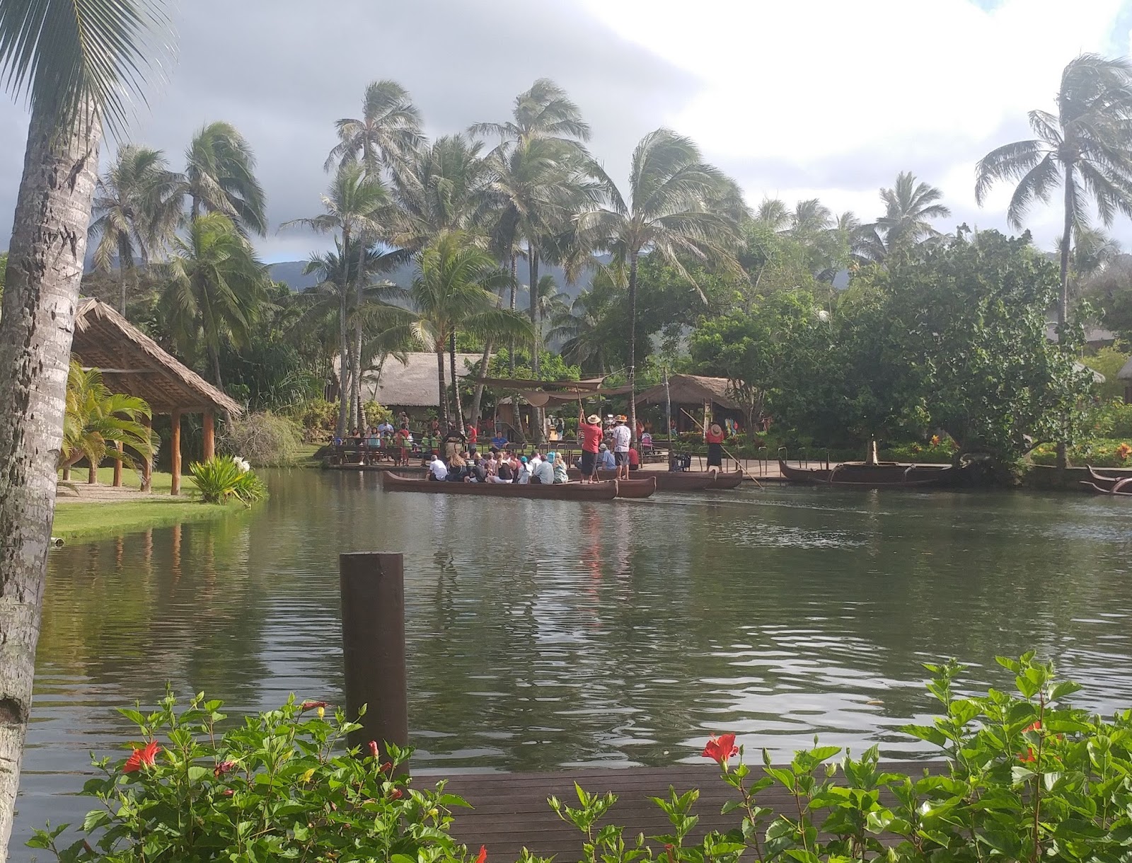
The villages offered canoe rides on the river that connected the islands.
The next Polynesian village I visited was Tahiti.


The presentations we got to watch included a demonstration of how they use their tools and weaving.


Tongo was the last village I visited. I watched a show where they brought people in from the audience to imitate them on the drums and sounds, and to answer questions. It was hilarious!


Then, I saw an exhibit that had Moai statues.

Finally, I hopped on a bus and took a tour that was part of the ticket I bought. They said it was to talk about the Polynesian life in Hawaii on the island. I admit that I was very disappointed to learn that it was all about promoting the Church of Latter-Day Saints.

We drove by Brigham Young (I hadn't known there was a HI branch)

And they mentioned there were lots of people from all over the world (and many from Polynesian islands) who came to this university.

Then they dropped us off at the temple. We weren't allowed to see the temple (aside from a distance), but were encouraged to go into the "Visitor's Center" where they educated us on their religion and tried to get us to sign up. I wasn't happy, but the bus wouldn't return for 20 minutes, so I tried to make the most of it.

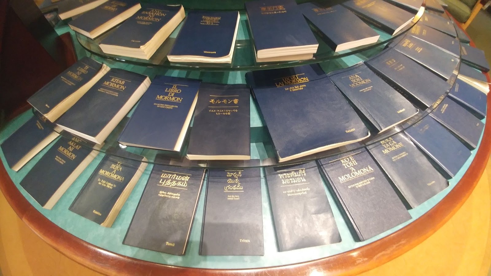
They did have the Book of Mormons in almost every language. LOL
But since I couldn't go inside without someone approaching me to talk about the church, I opted to go outside and watch the flowers and wait for the bus. The temple did look lovely.

I returned back to the Polynesian Cultural Center in time for dinner and the luau. We got fresh flower leis (which is good because my shoes and clothes didn't smell the best) and I had a mango pineapple drink (non-alcoholic, unfortunately).


This is the pig we'd be eating. :-)


Here is a sampling of the dancing / story telling we saw during the luau. It was interactive as well, so people who had an anniversary, for instance, got to go up there and do a dance.


After the luau, the last thing I did in Hawaii was attend the evening show, which was about the best thing that I saw on the island!!! We weren't allowed to take pictures or video, so here are a few pix from the Internet so you can see a glimpse of what was going on.
It was a story called "Breath of Life". A woman and her man had a baby and they are welcomed by the community. The child grows up and learns to be a man. It ends in death. The story is told in the native Hawaiian language and through dance like a musical with fire as well. :-D It was brilliantly done by native Polynesians from the island.
discoverhawaiitours.com

dulichchauaugiare.com.vn

polynesianculturalcenter.com


And with that, I drove back to the south side of the island, returned the rental car, boarded the plane, and said good-bye to Hawaii.

No comments:
Post a Comment