

This was the type of place where you kept everything off of the floor and slept on top of the covers with long pants and a long-sleeved shirt on...just in case.
In the morning, I stopped by the store to pick up firewood, marshmellows, hotdogs, and water to camp out tonight. I arrived at Kings Canyon via Hwy 180 - the north side of the park. The park is divided up into 5 parts. This first part was Grant Grove.

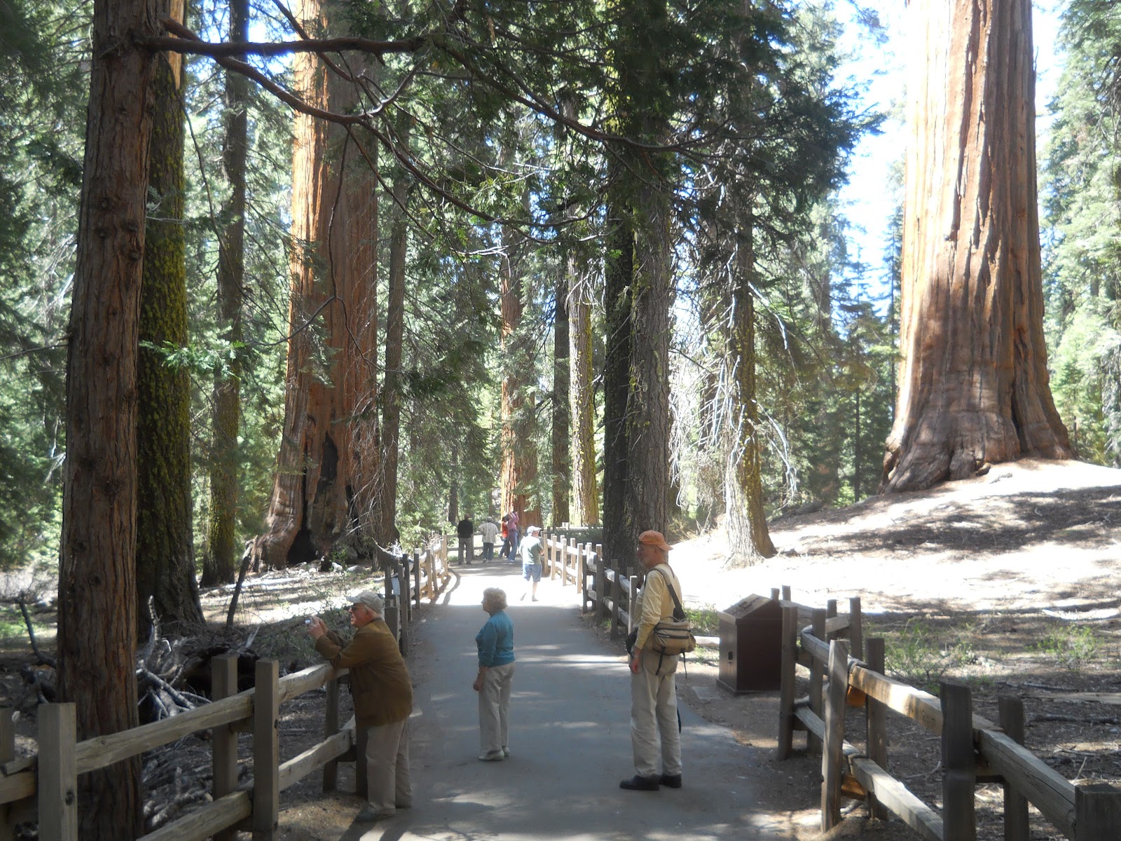
I went for a short hike on the Grant Tree Trail. It was impossible to take a picture of the entire giant sequoia tree, or to get a good idea as to how large and wide the trunk is, but over the course of the day (and into tomorrow), you will see more pictures with people and cars next to them, including other "normal" pine trees that look like twigs in comparison, and should get the general idea. :)
Young sequoia trees tend to be bushy until they get to be about 5-8 ft tall. Then they have a growth spurt and get tall and skinny - just like guys in high school... The ones in the picture below are over that 5-8 ft tall mark. The ones we will see later on are about 1-2 feet tall and look much fuller and wider. There were no "babies" on this trail - only children.


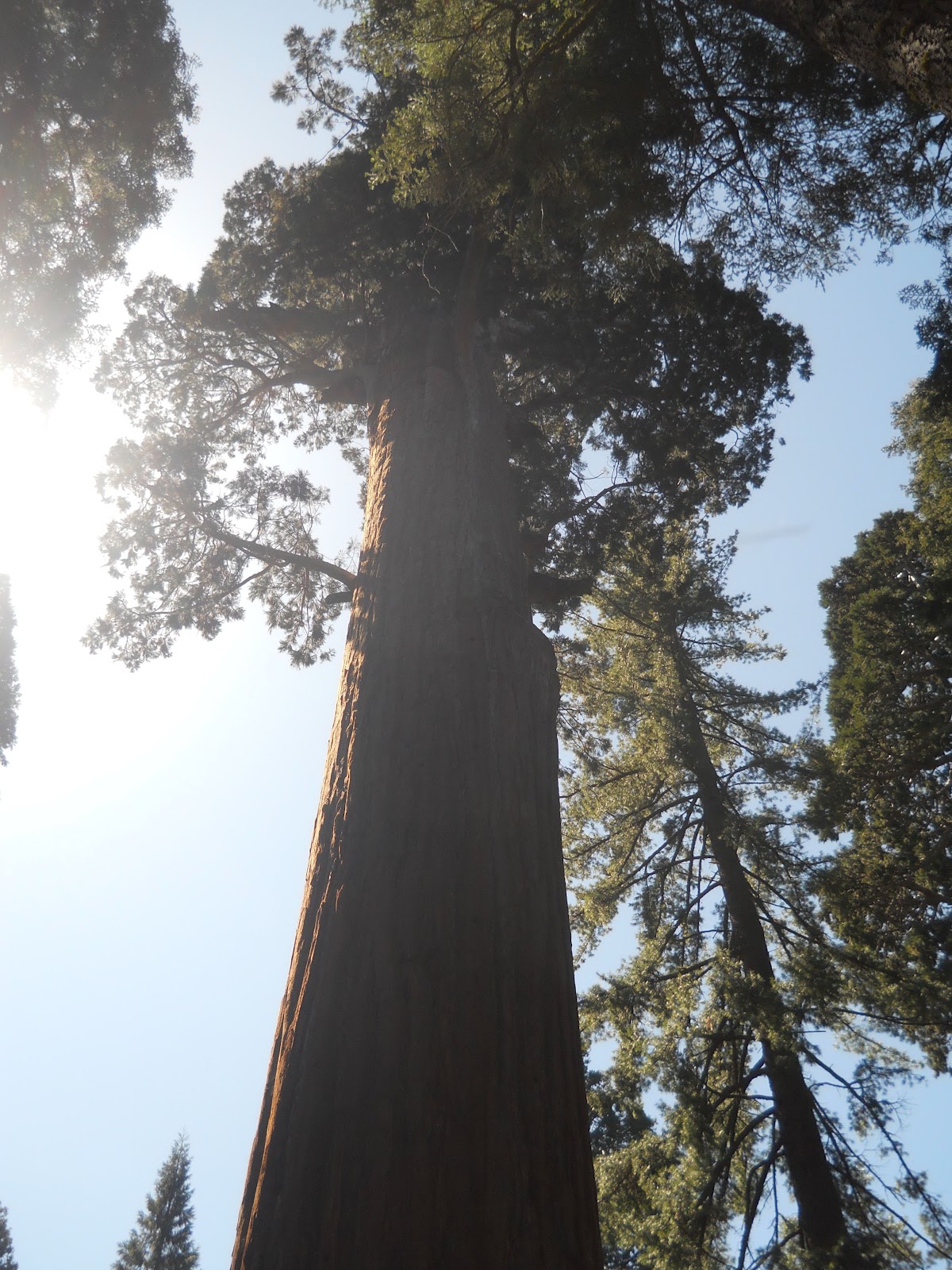
Next is General Grant's tree, which is a good example of a mature adult. Because the adults are so well proportioned, it is difficult to really appreciate their size until you see them next to "normal" trees (or see a handful of people at the base of one). This is one of the only pictures I was able to take of an entire sequoia from the bottom to the top.

Next I saw the Tennessee tree. This is a good example of one that has been through fires. Unlike normal pine trees that burn to the ground, sequoias can survive and continue to thrive after severe fires. The living tissue is under the bark. As long as some of that living tissue connects with the leaves above and roots below, the tree will survive. Some have been through multiple forest fires.

Here are a few more of the sequoias:


In 1872, the Gamlin Cabin was built. He and his brother filed a timber claim on 160 acres in Grants Grove. Once this park was created, the cabin was used as a storehouse for US cavalry who patrolled the park, and later, was the quarters to the first park ranger here.


You can't see anything burnt on the top, but a little of the fire at the bottom (below), and the fir tree they climbed (to the right of the sequoia above).

This is a log that fell over. Most of the sequoias die by falling over, and most fall uphill (no clue why). There are people walking through the log (below). And this isn't even the largest!!!

When I finished this trail, I drove toward the 2nd part of the park, which is Cedar Grove. On the way is the Sequoia National Monument - not part of the park. As part of the monument is the Converse Basin Grove.

The first dirt road I turned onto led toward the Chicago stump. The brochure did not indicate that high vehicle clearance was needed or having a 4wd vehicle. It was incredibly bumpy and difficult on the Focus. Worried about damaging the undercarriage or getting a flat tire. There was a little hike to the stump, and I actually parked the car and walked the rest of the way on the dirt road for fear that my car wouldn't make it back!
This is called the Chicago stump because no one believed the tales about how big the sequoias actually were, so an entrepreneur cut the General Noble tree down and exhibited its stump at an exposition in Chicago.


I was so happy that my car made it out and knew I had one more dirt road to travel on. I vowed to avoid this trail if it looked like the other one did, but it was a tease! The first couple miles were nice and easy on the car. Then, when it was too late to turn around, the road had very steep incline and declines, with loose gravel, pine branches I tried to avoid, large potholes, wide uneven cracks, and rocks. Even in first gear going as carefully as possible, my little car was having an extremely difficult time getting up. I held my breath a few times and prayed I wouldn't slide backward down the hill!
On the road was the stump meadow. It is appropriately called this as it looks like a meadow full of nothing but giant sequoia tree stumps.


Converse Basin Grove was the largest sequoia grove in the world. As you can see in the map below, a lumber company used this to chop up the sequoias and sell the wood. All that remains are the stumps.

I got back in my car and kept driving until I reached the entrance to the Boole Tree trail. I had no idea at the time that I was the first person here and that the trail just opened. In fact, according to the rangers I met later on, it might be a few days before another person came down that terrible dirt road to go on this trail. The trail was 2.5 miles, narrow, with a few few elevation changes.

The first mile was through forest getting to the Boole Tree. The trail smelled like pine from the trees and pine needles I was walking on. There were bees everywhere that seemed to be following me around, but I tried to forget that I'm terrified of bees and kept moving forward. I was looking out for bears as this seemed like the perfect place for bears to be. No bears (thankfully).
Here is the Boole Tree. It is the largest tree by volume in any national forest (this doesn't count what is in the national parks). I was able to set the timer on my camera and took a picture of me next to it so you can see how big it is!! :)


After that, I continued down the trail. About .4 miles along there was a hairpin turn with bushes and trees pushed right up against both sides of the narrow pine needle trail. I saw movement in the bushes and assumed it was squirrels or birds playing there. I thought it might be a bear and stayed as far to the left as possible. However, when I passed by, I saw the angry face of what I later learned was a mountain lion growling and snarling at me. My entire body froze and adrenaline kicked in. I don't think I have ever been so terrified! I thought about running, but figured that would only make it want to chase me. Instead, I kept walking at the same pace as if I wasn't scared. I kept looking over my shoulder and listening to see if it was following me. Nothing. Thank God!! With my heart still pounding and wishing I had a boyfriend to hike with, I found a solid stick a little ways up the trail that I used as a walking stick, and put some small rocks in my pocket. I had read the ranger's advice on what to do if you meet a bear or mountain lion and at least now I felt a little more prepared (though I'm not sure how much those weapons would help me).
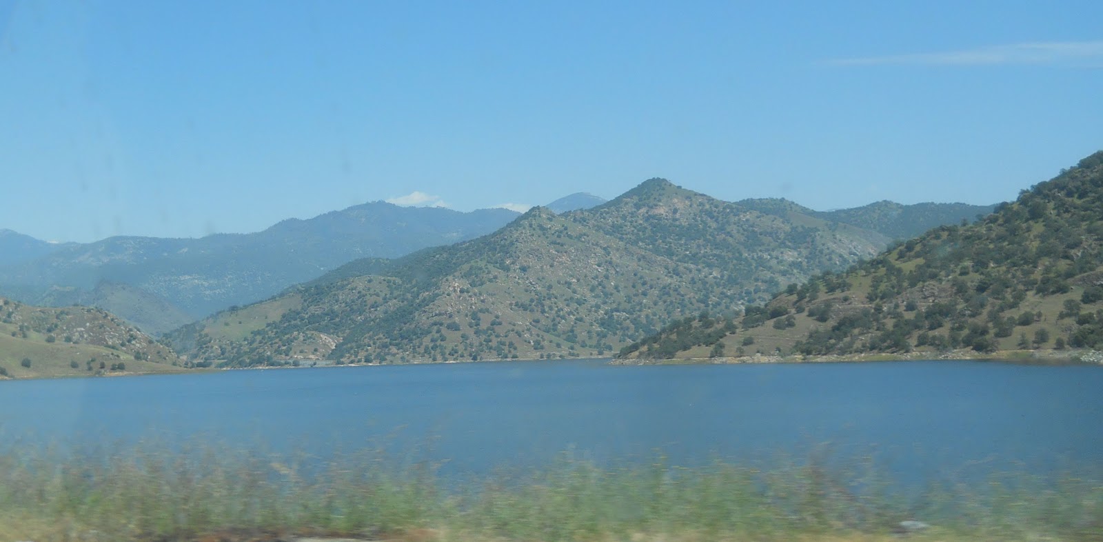
About another short distance down the trail I came across a closed fence. Crap! I assumed from Yosemite that this meant the trail was closed. No way was I going to go back the way I came! Upon closer examination, it was just closed and a sign said to close it after passing. No problem. I felt safer on the other side of that fence. Here were some switchbacks and a beautiful view of the mountains in the distance. More of a meadow feel than a forest, which was quite welcome.


The last 3rd of the trail consisted of going through a gate on the other side and once more moving through the forest, but I walked quickly and made it through without incident. You could hear King's River, but I couldn't see it.
At the end of the trail I was so happy to see my car, but also scared that it wouldn't make it out of that area (I remembered how challenging the dirt road was on the way in). Finally I made it out and vowed never to use my car to go "off-roading" again!!!
I checked the tires to make sure pressure was still good and then took off on the paved road. It felt so good to put my foot down on the accelerator again - bump free!! I still had to tell the park ranger about the mountain lion encounter, but wanted to get through Cedar Grove first. This was a very long and beautiful road with several overlooks and other places that just made the drive go by quickly. I was not in a race to get to the bottom and drove most of it at a reasonable pace.
When I entered Kings River Canyon, I had a great view of a number of peaks, including the Spanish Mountains, Rodger's Ridge, Crown Rock, Obelisk, Silver Spur, Mount Harrington, and University Peak.


There have been a lot of elevation changes on this trip (which reminds me, I should have my brakes checked...), and I often hear the plastic on my water bottles crackle as it crushes or expands. :)

I stopped about 1/2 way down the mountain after seeing a sign for ice cream. :) There was a beautiful yellow lab, friendly as could be, that ate with me and another couple at Kings Canyon Lodge. The inside looked like a cabin with all sorts of stuffed animals. I ordered a grilled cheese sandwich to go with my ice cream and sat outside to be with the dog and the older couple, and enjoyed the fresh air.


I left there and drove down the rest of the way to Cedar Grove. The scenery was incredible!


Boyden Caverns was at the bottom of the mountains and the road flanked Kings River, opening up to beautiful views (and sounds) of the rushing water.


I then drove to the Cedar Grove Pack Station as I wanted to go for a horseback ride. How can they still be out of season??? :-( Not sure, but they were.

Then I left and headed back to the main road to continue down to the end. There was some construction.

Canyon View was next, though there were a lot of trees in the way obscuring the view.

Then I came to Knapp's Cabin. George Knapp was a wealthy businessman who conducted several elaborate camping trips out here. This cabin was built during the 20's as a storage shed for his expeditions. It is the oldest building in Cedar Grove. The forests and mountains look great together, so I took a couple of scenic pictures in the area as well. :)


Then I came to Roaring River Falls, which was just a short hike along the river.


After that I came upon Zumwalt Meadows. There is a trail that goes around the meadows. I didn't walk around the entire thing, but enjoyed the meadows.


The purple lupine has a soft fragrance that I would love to put into a candle or use as bath scent. It wasn't bad to look at either.

On the trip back up the mountain, I found a few additional places to stop for photos. :)


The redwood mountain grove is the largest grove of sequoias (not chopped down).

Getting back to Grant's Grove there were a few other overlooks and sequoias right by the edge of the road. It was a great drive.


You can see the difference in size of the sequoia trunks compared to the other pines.


By this time it was starting to get late.

I set out to find a campground, but most were closed (I guess because of all of the snow still up there). I drove through the Giant Forest area and stopped at Lodgepole, where for $18 there were plenty of camp sites available. It was at about 7500 ft and there was still snow in some places. It didn't feel that cold...yet, though most of the campers were in RVs rather than tents.
I put up the tent, blew up my small air mattress, and started a fire. The dry pine needles all around me made for good kindling to help start the fire. Made myself four hot dogs and ate all of them (they were small). Saw lots of blue birds in the camping area. Hoped NOT to see a bear. LOL Then I had chips for dessert.


I loved being able to set the timer and take a picture of myself. I did look around for a cute boy to take the picture, but sadly, there were none that were single...

By the time I put all the food away, the sun was setting and the temperature was dropping.

I had a long sleeved shirt on and thick fleece. Couldn't find my Mammoth Lakes wool ski hat, but I did put on my Ex3 coat. Then I got out the marshmellows and had a few of those, and when my tummy was full, I put everything away and used the water to wash my hands (which somehow had became incredibly black, white, and sticky). LOL

During the night, despite wrapping the blanket around me and over my head like a burrito, I was so cold I had trouble sleeping. I also found that if I moved at all, the blanket would let freezing cold air in, which didn't help. Finally, at 2 AM, I used the flashlight, went out to my car, turned the heat on full blast, went to the bathroom and kept the car running. Then after about 15 minutes of heating the car by my tent, I shut it off and curled up in the driver's seat with my blanket until morning. Yes, I did have a kink in my neck, but I wasn't quite as cold.
At 6:30 AM, I turned the heat on in my car again (my hands were icicles just from stepping outside), put the tent away wet and full of sand (to be rinsed off once I got home), and tossed the rest of the food in the bear-proof containers. I considered going on the 3 mile waterfall hike, but the rangers weren't around until 9 AM, and after the mountain lion scare, I decided I wasn't ready to do a long hike alone in this area...
Instead, I took off to explore some of the other, more widely traveled, trails. The first one was the General Sherman Trail.

This is where you can see the General Sherman Tree (the largest tree in the world). The amount of space taken up by the trunk is greater than any other tree. It is a monarch sequoia - the top is dead, so it stopped growing vertical at 275 ft, and it has a huge cylindrical trunk, which makes it the world's largest tree by volume. Each year the tree is alive, the trunk gets thicker. In fact, each year, enough new wood is created to equal a large tree!! It is 109 ft around the base of the trunk.

The picture above doesn't look that big. But, look at the trunk compared to the twigs (normal large pine trees) next to it.


It's volume is 52,500 cubic ft and 36.5 ft in diameter, and it's only 2200 years old!! In fact, it is 1000 years YOUNGER than the oldest ones, so if it continues without falling over, it's volume will continue to increase quite a bit!!

Why do they get to be so much larger than other trees? Sequoias live to be > 3000 years old and grow very quickly compared to other trees. Their bark and wood contain tannins that ward off disease, rot, and insects. The thick bark also provides insulation against fire.

The cross section of the tree (see below) can tell the story of it's life. Not just how old it is, but also where it has been damaged and healed (e.g., by fire).

When I finished with this trail, I moved on to the Round Meadow and Big Trees trail. :) You will notice that no trees are in the meadow area. Why? There is too much water in that area for the trees to grow. Notice also how some of them have pointed tops and branches all the way down. They are "sun worshipers" and, like sunflowers, turn toward the sun and use all branches to gather as much sunlight as possible.


Here is another one with severe burn marks on the trunk, but still kicking strong. :)

The base of this sequoia is 34 x 25 feet as you can see by the outline below. I had a difficult time trying to even capture it all in a photo!


I went up the narrow road toward Moro Rock after this trail and came to the Auto Log, which is 21 ft in diameter. It fell in 1917 and since then, many types of vehicles have been photographed with it.


"The people of the adjoining country and tourists are awakening to the benefits and beauties of the park and desire to protect the game and forests..." - Colonel Young


Earlier in this post I mentioned baby sequoias. At the end of this trail I found some. :) You can see how bushy they are compared to their height.

Along the road I came across the Parker trees, named after the 8 members of the Parker family.


From there, my little Focus fell in love with one of the trees - the tunnel log. :-)

Now time to put the car in park and do a little hiking. :-) I combined a bunch of trails, improvising as I went, for a nice long, but relaxing, hike. I started off by going 2 miles up the High Sierra trail. I wanted to see Eagle View, but missed the sign for it, and went an extra mile. Oops. :-) This is a more primitive trail than some of the others with drop offs and rocks, but it was fun and had a great view of the mountains! I could keep going all the way (60 miles each way) to Mount Whitney, the highest mountain in the continental US at 14,497 ft. The only thing that bothered me was that there were so many bees, and they weren't sweet little honey bees, but yellow jackets and black hornets buzzing all around me as I walked. I didn't stop or shoe them away, but walked at a decent pace, occasionally picking up the pace if one seemed like it was more interested in me.


And here's a silly shadow shot of me with my walking stick. :)

On the way back, I turned off onto the trail leading to Tharp's Log. A short way out was Log Meadow, named for all the logs in the meadow.


From there, I detoured onto Trail of the Sequoias.


Then I went back onto Tharp's Log trail, where I lost the scent by the stream. The trail just seemed to end. Finally, I noticed that it continued faintly on the other side of the stream. I guess I was supposed to know I had to cross the water. LOL


Hale Tharp first visited Giant Forest with 2 Indians in 1858. He made a cabin out of this log and lived in it each summer from 1861 until 1890, when the park was established.


From there, I met a couple hiking from the meadow, and backtracked with them a little bit to go up to Chimney Tree.

Then we finished the trail by connecting to the Crescent Meadow trail, which lead back to the parking lot.


The Crescent Meadow was supposed to be full of colorful wildflowers in spring. However, as you can see from the photo below, it was snow. LOL

Moro Rock was the last climb that I did. It is a 1/4 mile staircase to climb, but not difficult at all.

Here is the Great Western Divide.

And the view from the top of the rock.


Yes! Another successful and enjoyable park has been conquered. :) Unfortunately, getting out through the bottom was a disaster! There were 2 hour delays as it was one lane the entire 30+ miles, and we had to wait until 12:30 pm for the lead truck to take us 5 mph down the road. Patience MJ... Patience. While waiting, I noticed a tree growing sideways from a rock. I wonder what will happen to it in 40-50 years... :-)

Once we got out of the construction zone, I hoped the slower traffic would adhere to the traffic courtesy rule of pulling off onto the turnouts to let others pass. Of course that didn't happen, so the ride back was fairly slow.

Then it opened up a little bit, and I went back past Fresno and into Yosemite again, where I had to pay again. :-( This time, I went to Glacier Point. I was hoping to get a few hikes in from here, but it ended up being too late. On the long drive up to Glacier Point I did see a well fed coyote, who looked suspiciously like a grey wolf. LOL


There was an overlook right before Glacier Point, which showed Vernal and Nevada Falls (the 2 that I had climbed a few days before) and Half Dome.


Then with a slightly different view, as well as a view of the Upper and Lower Yosemite Falls, is Glacier Point.


After leaving the park, I exited along Tioga Pass to return to Mammoth Lakes. The sun was setting during the drive, making parts of it quite beautiful.


That's one of the fattest coyotes I've ever seen. Pretty. I need to visit that forest. Love your mountain sunset too! :)
ReplyDeleteNice photos
ReplyDeleteGood views. Good report.
ReplyDeleteGood views. Good report.
ReplyDelete