
They washed my shoes, which took about 10 minutes. During that time, I bought a helmet and knee pads, along with a 2nd small back up flashlight. I wanted a headlamp, but the guy couldn't figure out how to put it on the helmet without it falling off, so I returned that one and went with the hand held. I had a large flashlight in my car that would be my primary source of light.

It was already 3:30 PM, so I didn't have too much time to explore the caves. I still wanted to at least get 1/2 way into most of the caves to see how they differed from each other. There were other things to do than the caves, but that was the highlight. And despite going through all caves, I did not see any bats. :-(
Valentine Cave (named for being discovered on V-Day in 1933) was the first one I explored, which was one of the few not part of the cave loop. Unlike the caves in the cave loop, this was created from a different lava source, so it has larger walkways, higher ceilings, and smooth walls and floors. The flash from my camera makes it look like the caves are lit up, but in reality, it is pitch black in the caves, and the light from flashlight barely helps you see where to step and how low the ceilings are.


After Valentine Cave, I entered the caves in the cave loop. These varied in difficulty level. I went through all - even the most difficult - and was soooo happy that I had bought the knee pads and helmet. The only thing I wish I had was something to protect my back...
This next cave was called Thunderbolt. There were areas in this challenging cave that were very narrow and short, requiring me to crawl. I even had to slide like a snake through one part that was less than 2 feet high (see the last picture). You can see the sharp chocolate colored ceiling as well, which was a pretty neat design. These caves also had multiple places you could go through, so you had to remember where you were.


After Thunderbolt was the Golden Dome. This cave had a golden ceiling in some parts from light reflecting off of water drops on bacteria. You can see this in the pictures. I took several pictures of the ceiling and walls so you can see what the bacteria looked like. In order to get into this cave, you had to go down a flight of stairs and try not to bump your head.

Here you can more easily see the gold color. It actually looked like gold in the cave from the picture, but in the dark, I couldn't see the color "gold".

This is what it was like with the flashlight. :-)


Next were the Garden Bridges, which were basically caves covered only by short bridges and then being exposed to the sun.


I made a friend along the way. :-)

And then there was Hopkins Chocolate cave, which is named this way because of the chocolate brown color of the walls and ceilings. I am including a lot of pictures from this cave, but since many of the other caves are similar, I will limit the pictures from the rest of the caves. :-)


This is what it looks like with no flash and my flashlight turned off. :-)


Someone from 1892 left his/her mark. :-)


The most difficult cave was next - the Catacombs. This was over 6000 feet long with many, many places you could turn into to get lost. I went in by myself and didn't have a cave map, so I only went about 1/4 the way in. The beginning was easy to walk through, with only a few places to crouch. However, I liked to explore some of the lower, narrower passages off the beaten path - some of which were no more than 1 foot high. I hit my back a few times without even trying to lift my tummy off the ground as I slithered underneath. It was hard to do as my camera, extra batteries, and other small flashlight would fall out of my jean pockets. I had to push my big flashlight forward inch by inch as I crawled through. This was fun, but I was also happy to get out at the end! It was getting close to 5 PM and no one else was around.


Here you could see multiple passageways.


This was the hardest area to get through as it was no more than a foot high.

This is what the walls toward the beginning looked like. There were high ceilings in this area, though I still found myself ducking out of habit.

The Sunshine cave was next and was rather short and easy. There were areas where the sunlight came through, so the flashlights were only needed once in a while in this cave. The ceiling of this cave looked like a skunk and was a nice change.


Next we come to the Hercules Leg cave. If I went far enough into this one, it would have connected with the Juniper Cave. I almost got lost in it as it is, so I'm glad I turned around when I did.
You can see there is less than a foot of vertical space for me to crawl through here. I was taking a "short cut". :-) It was actually quite an ordeal trying to get the camera set up. LOL But once I had the camera out, I put the timer on and took 2 pictures.


This was a balcony. If you wanted to explore this passageway, you had to climb up. Looks like a milk chocolate waterfall.

More opportunities to get lost. :-)

This was the Juniper Cave.


The Sentinel Cave was the last cave in the cave loop. This was an easy one, and the only one that had an entrance and exit. I entered through the upper entrance and then it was a short walk back to the car from the lower entrance, which is where I exited. This was also very kid / family friendly. It had high ceilings in many places and had a bridge to cross rather than having to walk over the rough spots.


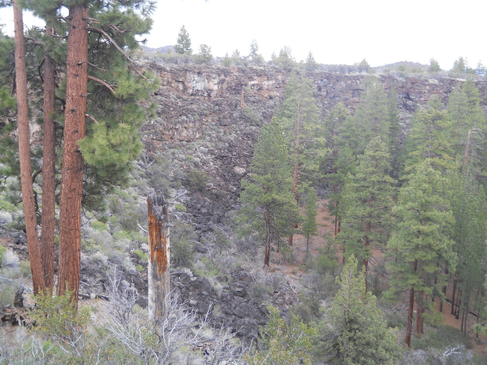
I left the cave loop right before they locked the gate and realized I still had a lot to do before sunset! Moving along the main road, I stopped to take a couple of pictures of the scenery at the Bunchgrass Overlook.


The Heppe Ice Cave was next. This was a 0.8 mile round trip hike, and I had to climb down a bunch of rocks to get to the entrance of the cave. You couldn't really hike through this cave, but there were other ice caves where you could actually see the ice inside.


From there, I drove down the dirt road about an extra 1/2 mile to the Mammoth Crater trail, which was not far. About 30,000 years ago, red hot lava from this Mammoth Crater flowed north in streams that were miles long. Lava tubes form when the edges start to cool and harden, creating a roof that insulated the hot liquid inside (like ice on a river keeping the water below from freezing). When the flow stopped and the lava flowed out, the lava cave was left behind. Part of the ceilings would collapse, which is why you have many smaller caves rather than one long 10 mile cave.


Another 0.4 mile round trip hike passed by Hidden Valley.


Skull Cave was the next stop. This was an ice cave.

There were hundreds of large animal bones (hence the name) discovered here. Lava beds don't have surface water, so the year round ice found in the cave helped humans and wild life survive through dry seasons. Ice is replenished by annual surface runoffs. The ice floor used to be so clear that you could see several feet down. Since people have been walking on it (which we can't now), sediment has covered it, greatly reducing the quality and clarity.


It's hard to see the ice, but that's what is on the floor below. You can see all the dirt on it.

Symbol Bridge and Big Painted Cave were the next 2 places to visit. These were along the same route and were a 3.0 mile round trip hike.
Big Painted Cave was first. This cave became a significant site for Native Americans. You are supposed to be able to see rock art but I didn't see much of anything here). The meaning of the pictographs is unknown.

This was also an ice cave, but I was not supposed to slip down into it (very tight fit) to explore it. Naturally, I wanted to see what was down there... :-)

This is the ice floor.


Symbol Bridge was discovered thousands of years ago by these ancient ancestors of Native Americans. It was likely of cultural and spiritual significance. These prehistoric visitors left their mark through pictographs. You can see many more pictographs here than the previous ice cave.


Next I went to Merrill Cave. In the 1920's, there was so much ice here that people would ice skate on it. Now, there is very little left. In 2000 it warmed up enough to start having the ice melt. When ice melts, it emits energy that heats up the cave, melting the rest of the ice.


The sun was starting to go down as I made it to the fire lookout at Schonchin Butte. There were a couple of miles of unpaved roads to drive through. Since I wasn't going to hike up it due to the time, I only went about 1/2 way. The clouds made a beautiful picture as well. :-)


Continuing on, I came to the Fleener Chimneys, which is also along an unpaved road. These chimneys are actually spatter cones. They were cones with built up hot gases inside. When it finally burst, globs of lava spurted into the air. When the lava cooled, it formed the spatter cones. Less explosive lava later flowed out, creating the massive Devil's Homestead flow. The magma that formed both came from a fissure in the ground that ran along Gillem Bluff. These 3 spatter cones are about 50 feet deep.


It's just about 8 PM and I still have a couple more hikes to go. Next was Black Crater. 2000 degree lava came through the land, disintegrating the trees and other things in the way. However, many of the larger trees had enough moisture in them that they cooled the lava enough to leave a tree mold (cast) behind. You can see the texture of the bark frozen in time. I didn't see any tree molds here, but did see some in later parks...


In the same area as the Black Crater was the 2 mile round trip hike to the Thomas Wright Battlefield site. Through the winter of 1872-3, the Modoc Indians resisted attempts by the US Army to remove them from their homeland. Driven from Captain Jacks Stronghold, the Indians moved to this spot by April. Knowing the land, the Indians were able to ambush the US Army to avoid capture for a while. Disagreements among the Modocs caused them to weaken as they divided among themselves. Survivors of the Modoc War were exiled to Oklahoma, where many died, and those that remained lost their traditional culture.


During the April 26 ambush of the US Army led by Thomas and Wright, Scarfaced Charley (one of the Indians) said "All you fellows that ain't dead had better go home. We don't want to kill you all in one day." The Indians didn't really want to harm the US Army. They simply wanted to protect their people and their homeland.


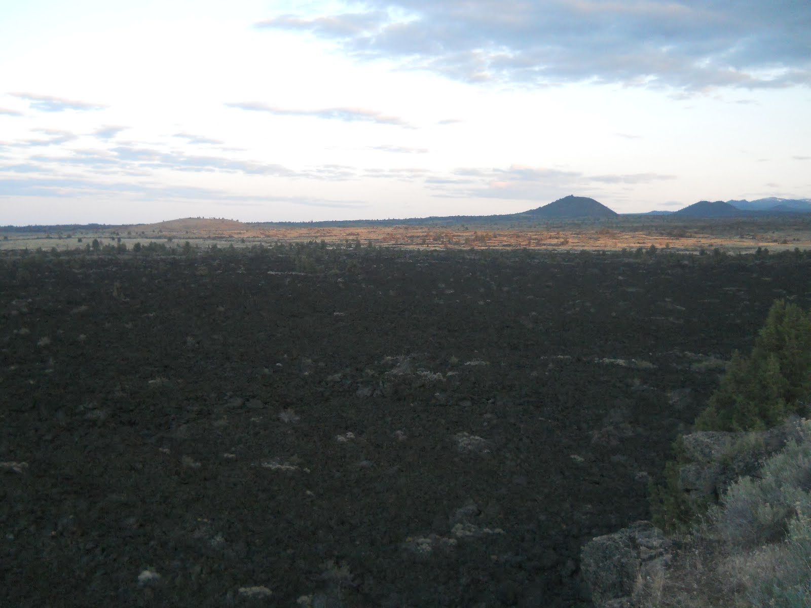
This is the northern flank of the Medicine Lake shield volcano, named for the gentle slope you see here in the sunset. Although it doesn't look like it, it's the largest volcano by volume. Hundreds of eruptive events spewed lava from over 200 magma chambers underground.


This is the Devil's Homestead. Within the fields of lava there actually is life. There is lichen adding color to the rock and tree frogs between the rocks. There are also pockets of soil where vegetation starts to pop through.

The next landmark I ran into had historical significance as well. As was mentioned previously, there was a war going on between the Indians and Americans in 1872 and 1873. At the beginning of the war, the US Army put together a peace treaty, which unfortunately, did not result in a peaceful ending. Captain Jack was the Modoc leader, and both leaders - General Canby from the US and Captain Jack - were caught between war and peace. The Modocs believed that if the US leader was dead, the soldiers would retreat, so they ended up pressuring Captain Jack to kill General Canby. Within minutes, there was another attack at Hospital Rock, where 8 Modoc warriors attacked US Commissioners. Along with Canby, Reverend Eleazar Thomas was dead, and Indian Agent Alfred Meacham was seriously wounded. Below is Canby's Cross, which memorializes his death.


As I drove to the last trail, despite the threatening clouds, the sky painted a lovely sunset.


Captain Jack's Stronghold was mentioned previously. This was the last place that I stopped at in the park. It is also the center of the Modoc Indian homeland. The lava stronghold was a focal point in the war for the US Army to remove the Modoc from their land. If they could remove them from this area, they would win the war. For almost 5 months, 60 Modocs were able to hold off the US Army on their lava land. The Modoc warriors retreated to the jagged landscape formed by a natural lava fortress, where the Modoc withstood 2 major Army assaults (one was on the Thomas-Wright Battlefield mentioned previously, and one was on this land called Captain Jack's Stronghhold.) Despite this effort, once the Army severed the Indian's access to their water source (Tule Lake), they lost the war.
Along this 1.5 mile loop trail, you can see all the lava rock, as well as the Indian's medicine pole. You can see why their knowledge of the land and rock allowed them to use it to their benefit to hold off the Army as long as they did.


No comments:
Post a Comment