
The Kule Luklo tribe used the tule grass to weave baskets, mats, canoes, and korkas (their homes). They also used redwood bark for the homes, and they stored acorns from nearby oak trees for winter food.


The Earthquake Trail was next. I had been excited about this after seeing the Earthquake Trail by Ralphie's place in Mammoth Lakes. However, this was rather disappointing. There was no split in the earth. No canyon to look down. The earth had not split. No, no, no. In fact, it just looked like a nature walk with a few interpretive signs on earthquakes. (I did get to see more deer though. LOL)
This is the San Andreas fault zone, which is where the North American and Pacific plates scrape against each other. (Remember plate tectonics in school?)


This was my view of the fault. As you can see, it doesn't look like anything special...

But these interpretive signs "teach" you about plate tectonics and earthquakes. These 4 images show how Point Reyes was created.

Basically, where the 2 plates (mentioned above) meet, friction binds the fractured rock to the fault. Over many hundreds of years, stress causes strain to build, until rocks reach their breaking point. Then, the fault slips releasing what we call "seismic energy" and we have earthquakes.
During the 1906 7.8 earthquake, this fence jumped 16 feet. Also during this earthquake, Point Reyes moved northwest about 20 feet!

There were lots of fires that burned much of San Francisco from that earthquake as well, and the dome from City Hall fell. (There are lots of other earthquakes that cause changes and damage. In 1989, a large earthquake damaged the Bay Bridge.)

A trail also jumped the track during the earthquake and tipped over.

I think this deer was looking for his other friends that I met earlier. :-)

After that hike, I drove for about 40 minutes to the Point Reyes Lighthouse. The road was nice and smooth in some areas, but would suddenly be full of potholes or gravel with no warning. There were no signs indicating "rough road". It was frustrating, because the park was spread out, so there were a lot of miles to cover, and I didn't want to ruin my suspension.
On the way to the lighthouse, you climbed up a cliff. This was an interesting shot of water mixing with sand.

To view the lighthouse, you walk about 0.8 miles to a rock and then climb down 150 steps. The steps were closed as I was there too early, but I was still able to walk down to the rock and see it. It was incredibly windy out!! My hair was blowing across my face and I had to put my sunglasses in my pocket to keep them from blowing away!
This lighthouse was built in 1870, over 100 years ago! Without electricity, at sundown, a lightkeeper would light the wick of an oil lamp inside the lens and the light house would light up.

There was a whale watching area, but I didn't see any whales.

This was a sea lion overlook, but it was very difficult to see them as I was so high up.

I zoomed in and you can see them swimming in the water.

Just a short drive from the light house was Chimney Rock (yes, another one). This rock was not one to look at, but to hike up to. It said it was only 0.4 miles, but that was to get to the rock. From there, you went another 0.6 miles to reach the end. There were deer on this path as well, and I had to keep an eye on the time as I had paid reservations for lunch. So far so good.


I tried to jog back to the car, but I was fighting the wind. It was cool, but became quite cold with the wind, reminding me of the weather in Cape Cod.
Just past Chimney Rock, was another short trail leading to an Elephant Seal overlook.


I thought this was an eagle at first, but there was no white head, so I'm pretty sure it's just a large hawk.

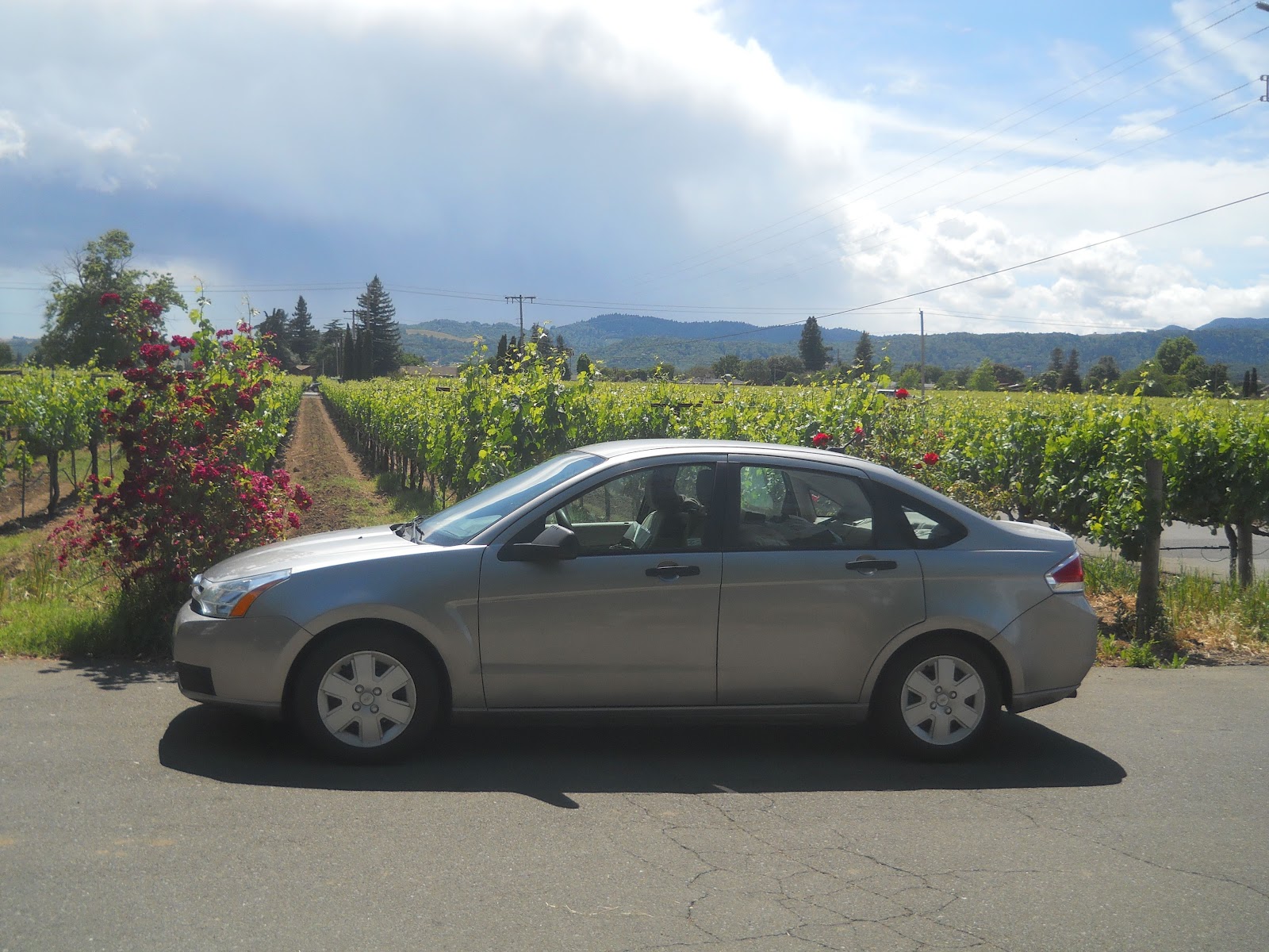
My car wanted a picture by the water. She's very photogenic. :-)

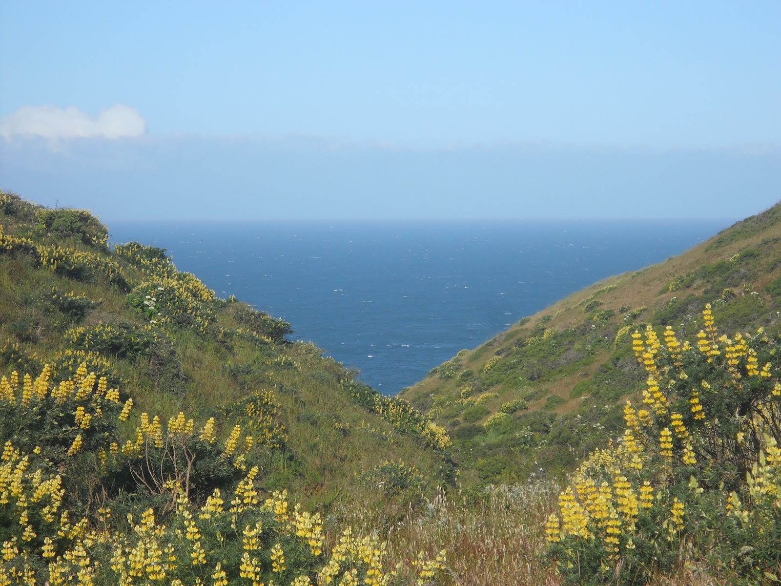
From there I drove over to Tamales Point. I didn't have time to walk down to the beach or go on the Tamales Elk trail, but the scenery along the road was gorgeous!!


John Deere is everywhere! Even by the ocean. :-)

I left Point Reyes at 8:30 AM, giving myself plenty of time to drive to Napa Valley for lunch on the wine train. The train was sold out, and it's amazing how many people you can fit on one train!!! Before lunch, we all met at the station and spent about 45 minutes sampling wine and learning about the vineyards we'd be passing and the wine we were tasting. Then we boarded. I was in the Silverado train (the less expensive one). The windows could open or close, making it a relatively cold car to sit in, especially once we started moving.


The train went less than 20 mph. There was one stop on the way, which was to let off (and later pick up) those getting off at Grgich Hill Estate for a wine tour. All together, the train ride was 3 hours.
I enjoyed seeing the cars waiting for us and seeing the red lights flashing. It is a different perspective seeing it from the train's view.

Lunch was on the way there. I had a glass of Chardonnay, lobster bisque soup, and a portabella mushroom sandwich with green potato salad. Creme brulee was for desert, but we didn't have that until the way back.

At the 1/2 way point, we reached the end of the track, and one of the engines - the one facing the "wrong" way - was taken off and moved to the back (now front) of the train.


During this 15 minute "down time", I walked from one end of the train to the other to see the other cars. There is a wine tasting car, other dining cars, cars with bars, the car with the kitchen, and even one with an upstairs for those willing to pay a bit more.


During the ride, a woman pointed out the different vineyards and some of their unique characteristics. For instance, Danielle Steele (romance novelist) has a vineyard in her backyard that we passed. The family of the woman talking with us also owns a vineyard, so we received passes for free wine tasting. (I did not go there as it was too far off the beaten path.)
On both sides of the train, there is an observation deck. It was fun to be up by the engine, and then the back where the caboose would be. Views were much better from there and you could wave to all the cars. :-)

It was sprinkling lightly off and on, and cloudy all day, but the weather wasn't bad. There were a lot of hills on both sides with miles and miles of vineyards making the view spectacular!!!.


This is where new vines have been planted. It will take about 5 seasons before they are mature enough to grow grapes for wine.

Many of the vineyards had large fans in several places. These were used at night when it was cold to prevent frost.


When I got off the wine train, I drove up and down the freeway adjacent to the train. There were a lot of wineries I wanted to see, but being Memorial Day weekend, it was very crowded and there was only time for a small number.
I started at Andretti Winery. Most of you know that Mario Andretti was a world famous race car driver, so it only made sense to start there!


Dominus (Latin for Lord of the Estate) is a winery far off the highway. What is unique about the winery is that the building is made of wire mesh and stone, which helps control temperature. If you look closely, you can actually see through the cracks into the building. However, other than the workers, this building was off limits to me. No tastings or tours...so the 3rd picture below was taken from their website to show the wire and stone.


From there, I stopped by Domaine Chandon, and sampled champagne. Wine tasting in Napa Valley is about 4 times as expensive as Virginia and Toronto, but worth it. I walked away with a bottle of rose champagne and a champagne flute (which will hopefully survive the trip).


I enjoy drinking Robert Mondavi wines, so that was my next stop.


There were a couple of wineries I went to, but didn't sample the wine as I was driving and already had a bit. These were the Sequoia Winery (named after the giant sequoia trees) and the Grgich Hills Estate.


The last stop in Napa Valley was the Castello di Amorosa. Due to traffic being at a crawl for 15 miles, I missed the last tour of the day (which goes down into the dungeon area). The sign leading up to the castello was also very small and poorly marked, so I ended up missing it and having to ask for directions about 5 miles up the road.

This is a beautiful old castle surrounded by vineyards. I walked around the different levels of the castle before going into the basement for the wine tasting. I tried the regular wines as well as the reserves, and had hoped to like the "La Castellana" (Lady of the Castle) red wine, but it was much too strong for me. I opted on buying a nice Chardonney instead.


As the sun started to drop and I was on my way back down the highway of Napa Valley to get to Sacramento, I saw the dinner Napa Valley Wine Train coming our way. :-)

It rained off and on, and before leaving, I saw a pretty double set of
rainbows over a vineyard. It made me smile and was a beautiful end to
an enjoyable day. :-)


No comments:
Post a Comment