
Gold was struck in Boise Basin in 1862, and the rush to these new mines came through Horse Shoe Bend.

Near Boise is where I wanted to go white water rafting. There were many canyons and I found a level III, IV, and V, which would prove to be fun, challenging, and a bit scary on the Salmon River! :-) It was pretty cold outside (50's), so we wore dry suits and rain coats under our life jackets. The boat that went out a few days before us tipped over and we were determined not to! (Luckily, we didn't as the water was freezing, though there were a few close calls.) Our hands were like icicles, but despite the cold, it was one of the most exciting things I've done yet on this trip!

Here, we are getting ready. We took a small school bus with the rafts strapped to a trailer on the back. Once there, we unloaded the rafts, put on our gear, and refreshed all the things we had to do and the commands to follow to keep from tipping over.

One of the guys went ahead of us a short ways in the kayak. He was our "safety crew" just in case something happened.


It was noon by the time we finished the rafting and I grabbed a hot dog and juice at the raft store to eat in my car as I tried to warm up. Then I went driving through the mountains. At the top of the pass you can see it had just snowed as the pines had a nice soft layer still on them.


You can see how massive the Sawtooth Mountains are by looking at the size of the pine trees. They look tiny in comparison!

This is the Yankee Fork Historic Area. The pipe in this river was created to divert hot water from the hot spring nearby to the Salmon River. The cold river water cooled the very hot water in the pipe and the water then returned to the bathhouse. The hot springs attracted chicken farmers, business men, travelers, and settlers, and you can see remains along the trails of life here a long time ago...


Alexander Ross and the Hudson fur trappers were the first ones to find this hot spring. His diary talks about the "boiling fountain" in 1824. You can see the steam in the picture. This is hotter than the last hot spring I was at!
Hot springs are created when hot water reaches the surface through fault fracture lines. The superheated water from deep below the earth collects sulfur, which, when mixed with hydrogen, produces the rotten egg smell common to hot springs.

This is historic Sunbeam. During the early 1900s, the town of Sunbeam flourished as crews operated the large mine and built the Sunbeam Dam on the Salmon River to produce power for the mining. The power plant by the dam only ran for one year before the mine closed and the town became a ghost town.


Custer City is another ghost town that used to be a mining town. You drive up a long dirt road for several miles filled with potholes, rocks, and gravel.

Searching a hillside across the Yankee Fork in 1876, James Baxter, Eldon Dodge, and Morgan McKim stumbled upon a rich vein of ore exposed by a snow slide that became the most famous mine in Yankee Fork! It's named after military General Custer, and this mining discovery turned the small mining camp into a flourishing community. For 30 years there was a wealth of activity, as well as periods of uncertainty and decline, until its final bust in 1911.


This is the Yankee Fork Gold Dredge. Small particles of gold and silver from naturally disintegrated ore is scooped up by the bucketline and carried to the upper hopper, where it is washed into an inclined rotating cylindrical screen. Rocks larger than the 5/8" holes work their way to the lower end of the screen and fall onto the stacker belt, which dumps far behind the dredge. The material that passes through the screen falls into sluice boxes. Since gold is 16 times as heavy as the gravel, water washes the gravel overboard, leaving the gold lodged behind the cleats in the bottom of the sluices.


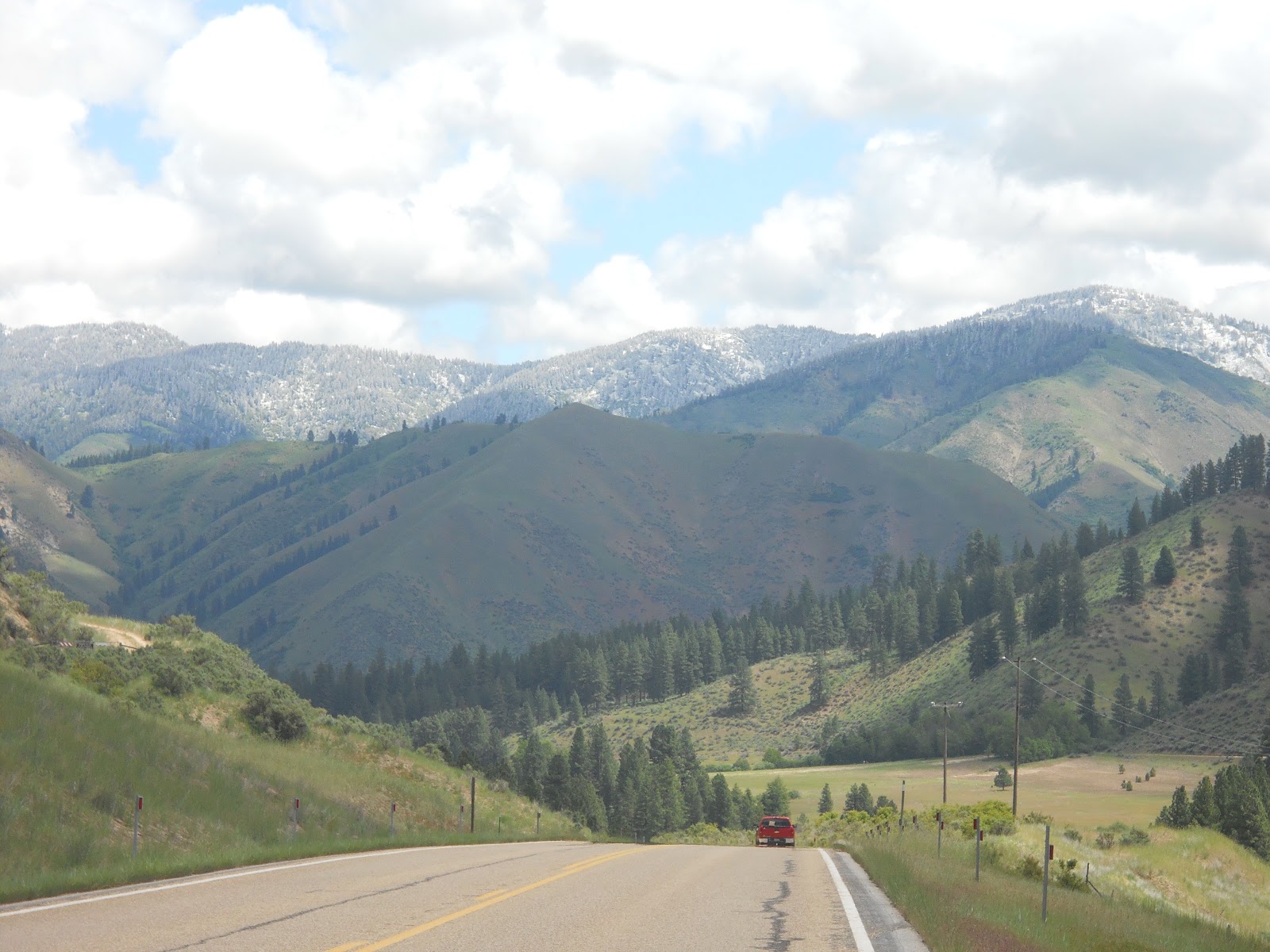
Central ID provides very scenic and beautiful landscapes. Cliffs, hills, snow-topped mountains, curvy roads, canyons and rivers... It was one of the few times I was content driving "normal". :-)


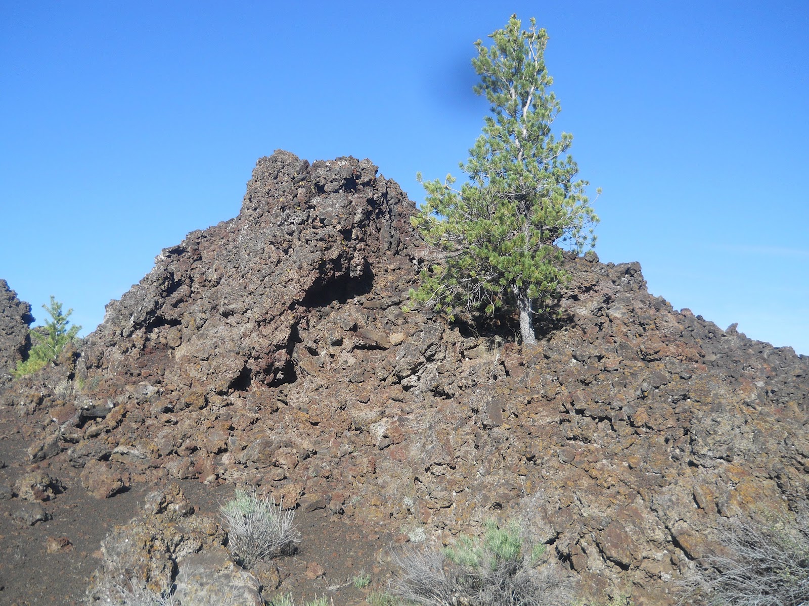
The next stop was Craters of the Moon. This was very unique and a must see for anyone in the area!!! So much lava! I was going to do this yesterday, but with the rain and high altitude, I didn't want to get caught in a snow storm crossing the mountains while trying to get there.


You are going to see more lava rocks than you ever thought possible here. :-)
The first trail I did was North Crater Flow Trail. Here in the path of a lava flow you can view a variety of volcanic features, now frozen in time. The trail crosses over the most recent of several successive flows that originated from the North Crater area. A long time ago, slow moving lava streamed around this trail while showers of cinders erupted high over the North Crater cinder cone.


The old crater wall broke open after centuries of rest and lava poured out, carrying great chunks of broken wall. It rested again, until 2000 years ago, when lava flowed out for the last time.

This tree's annual growth rings help determine that the lava is at least 1350 years old. However, we don't know how long after the lava cooled that the tree took root. Radioactive carbon and paleomagnetic testing indicate the flow erupted from North Crater about 2000 years ago.

Sometimes the pressure beneath breaks the crust and lava from below runs out on top. This is called a "squeeze up".

A new vent, a steeper slope, obstructions, and increased flow are all things that change the pressure on lava flowing in a tube. The pressure can heave up the crust and crack it along the crest. The deeper cracks in the pressure ridges make good homes for pikas, ground squirrels, and chipmunks. Weasels hunt them here.


You can see a young cone and an older one. The ages can be predicted by the vegetation and their form. Grassy Cone is about 7500 years old (more surface is covered by vegetation and shapes are rounded, with greater soil accumulation) and North Crater is about 2000 years old (much bare rock is still showing, and shapes are angular and less weathered).


Lava can flow 2 ways. The first is rough, jagged lava. The molten lava is much less fluid and usually moves slower. A crust never hardens on the surface, but chunks of cooler rock tumble along the top and sides instead. It can be impassible.
The second way is smooth or ropy lava (bottom left in the picture below). Cooler lava hardens on the surface. Hotter, more fluid lava runs under it, often leaving caves/tubes behind.

The rough, jagged lava from North Crater flowed north. The fluid, ropy lava flowed east. It could have been a few seconds or a few years that separated them. The first flow broke the west wall of the crater. The crater didn't explode - wall fragments just fell into the lava, which floated 2 of them here.


Devils Orchard is the next trail I followed, which is only about 1 mile round trip. As was mentioned previously, there was an eruption 2000 years ago. The information on this trail said that the volcanoes erupted so violently that they tore themselves apart. Rivers of lava floated huge chunks of crater wall to this spot as well (just like they did at the other trail). Time passed and rocks crumbled.
The trail got its name because 100 years ago, a minister declared this jumble of rocks, shrubs, and trees to be a garden fit for the devil himself.


These colorful little patches on the rock are lichens. They were the first plants to grow in the "orchard", and slowly dissolve rock into soil, where more advanced plants can take root. These lichen get damaged by polluted air caused by humans. The rocks get damaged when people step and climb on them. There are a lot of signs on the trails asking people to stay on the trail.


On a summer day, temperatures here at ground level can reach 150 F. In winter, you get cold, snow, and winds. There is not much rain that falls. Plants that can grow on black volcanic cinders triumph over adversity and have been some of the few plants able to adapt.


This is the Inferno Cone. You can climb up it (which I did obviously) and get a nice view of the national monument. Some of the rocks were very sparkly and looked like diamonds! :-)
Cinder cones (like this big one) form when gas-rich volcanic froth erupts high into the air and then piles into a mound.


On the recommendation of a website, I went up to see the big craters on the way to the spatter cones. This was part of the North Crater trail. While on the trail, I learned a little bit about the anatomy of a big crater. :-) The numbers coincide with the numbered picture below.
1. The elongated shape is from an eruption along the fissure instead of one central location.
2. You can also see remnants of earlier craters.
3. The "bathtub ring" is the rim of lava rock that used to be a lava pool filled at the bottom of the crater.
4. Oxidized cinders are cinders that have iron. (When exposed to steam, the iron oxidizes and turns red - think of red rust.)
5. Parasitic vents are vents that lava flows from at the base of an active cinder cone.
6. In a last gasp of activity, clots of lava were sprayed (spattered) into the cinders. The clots adhere to one another (agglutinate) to form a small lava flow. This activity is called agglutinated spatter flow.
7. During an eruption winds carried volcanic material northward. This is why the north wall is much higher than the south wall.

This is the trail up to the top of that hill, which then overlooks the big crater.


And these photos are from my vantage point of the crater.


Coming back from this trail I hopped on a very short one leading to 3 spatter cones. These miniature volcanoes formed when blobs of molten lava were lobbed into the air at the end of the eruption over 2000 years ago (the spatter flow in #6 above). The material in the picture below is a photo taken of actual spatter in a HI volcano. There was no active volcano spatter at this national monument.


Inside the spatter cones sometimes are snow. These are called "snow cones" (but we don't eat them). :-)


On the drive through the monument, it is amazing to see the black fields of lava rock. I have never seen anything like it and can understand the monument's name "Craters of the Moon"!!
These are the Lava Cascades.


The Broken Top Loop Trail was a 2 mile loop, and allowed me (and others) to hike up and around the newest lava (youngest volcano) on the Snake River Plain.


From here you can see where the lava stops and the foothills of the Pioneer Mountains begin. This is the northern boundary of the huge mass of lava known as the eastern Snake River Plain, which covers more than 7500 sq miles!! It also marks the north end of the 52 mile long series of cracks and fissures known as the "Great Rift".


Taking a little 1/4 mile hike off the main trail leads to an overlook of the big sink. This is a massive lava flow known as the Blue Dragon. You can't see it, but blue glass colors the landscape of the flow and the spiny surface reminded explorers who named it of dragon skin. It's one of the youngest lava flows in ID.

Cinders are the crunchy rocks that make up the trail. They contain many gas bubbles making them very light in weight. Some are even light enough to float on water! Thin layers of glass coat the cinders, creating prisms that refract light into millions of micro-rainbows (or as I said, they look like diamonds).

This is the Big Southern Butte. It looks like a volcano, but is actually a massive dome of rhyolite rock (the rock composed of the same minerals as granite in lava form). 300,000 years ago, rhyolite lava slowly rose up through the layers of dark basalt and broke through to the surface to form this peak.

During the creation of Broken Top, globs of molten rock (called bombs) were thrown out from the fissure. Some of them weigh over 100 lbs!. There are "breadcrust" bombs with an outer crust that cracks and develops like a loaf of bread. (Cracks occur when the surface cools quickly while the hot interior continues to expand.) There are also "spindle" bombs that form as hot lava spirals through the air, freezing them into twisted, bizarre shapes.

This is what's called a pressure ridge. Crusts of cooling lava develop on the surface of a lava flow when the hot lava comes in contact with cool air. The crust encapsulates the hot, flowing lava below, creating a roof. When the pressure under the roof increases, it forces the crust upward causing it to bend and buckle. The rounded, bulbous projections of lava that escaped from the ridge are called "lava toes" and can form at the edges of a flow where the last of the hot lava oozes out.

Buffalo Caves are part of the lava tube system. I did not go into this cave.

At over 700 ft high, Big Cinder Butte is the largest cinder cone in the monument. A fountain of fire at least 1500 ft high produced this cinder cone!!

Many of the rocks that are on this trail are the ropy kind.


There were also a variety of colorful wildflowers that popped up to bloom and add color to the black landscape.


The tree molds trail was just past this area and is about 2-2.5 miles round trip. I did not find this to be worth the hike as other parks have examples of this as well, but I wanted to check it out. :-) In order to reach the tree mold area, you had to walk about a mile. The area had a few that were accessible. Others you had to walk a bit further over the field to find.
How are they made? When molten lava advanced through this area, it flowed through a grove of living trees. As the trees burned, moisture was released as steam, cooling the hot lava just enough to leave an impression of the charred wood on the surface. I saw the same thing at the Lava Beds National Monument.


Speaking of Lava Beds National Monument, there are a few lava beds, or caves, in this monument as well.

Here is Dewdrop Cave. I didn't go very far into it, but you can see the lava flow in the walls.


There are a bunch of large holes on the sides of the trails that used to be lava tubes that collapsed.


It was well after 9 PM before the sun went down. I love these long days! You can fit so much fun into one day and still be able to enjoy the sunset on the drive to whatever destination happens to be next.


No comments:
Post a Comment