


At Lolo Hot Springs, there were large granite rocks near the swimming pool from the Lolo Batholith. The rocks crystallized from a fiery hot melt 50 million years ago. The granite fractured as it cooled, and continued to fracture later on from the the release of pressure as the rocks above it eroded over time.

I was disappointed to learn that the hot springs, although "natural", were turned into a swimming pool. I was looking for a "real" natural hot spring - not a man made swimming pool that used the hot water.
Upon the suggestion of those working in Lolo, I drove a short way off of Hwy 12 to the Warm Springs trailhead, which was a 1.5 mile one-way trek to the Jerry Johnson Hot Springs. There was a father and 2 sons at the hot springs when I arrived. It was very warm water (not too hot) and very relaxing. If you put your fingers into the sand in the hot spring, it became VERY hot!!!


From there, I drove to Colgate Licks, which is a small trail (that I don't think has been used by anyone all year before me). It's only 1.5 miles round trip and is an interpretive trail.

The trail was clear during the first 1/2 of it, but into the grass field, it disappeared. I followed the mule trail down through the mud (it was drizzling out) but didn't find the "real" trail. I did find several gophers, who would stick their heads out of the holes to look at me, and then hide when I came close. :-)


This is what's called the Colgate Licks. It's a natural mineral lick with hot (106 degrees F) water. The water comes from below the earth's surface, and has Calcium, Sodium, and Potassium (which get trapped in the soil). The minerals attract deer, moose, and elk, who create the "lick holes" nearby. The licks were named after George Colgate, who was the cook for a hunting party in the late 1800s. Heavy snow trapped the group, preventing them from reaching the Lolo Trail by foot. Undeterred, they built a raft to float over the river. It broke apart in the rapids, forcing the group ashore. Colgate was sick and not able to continue, so they left him behind. His remains were found later and he was buried at this site.

In the Colgate Licks I saw a young moose behind a log. I saw the brown and thought it was a bear at first. When I looked closer, it looked like a mix between a deer and a horse. I thought it might be a mule deer, but it wasn't. I went back up the trail and snuck around behind it to get a closer look. When it saw me, it ran away, but I still got a couple of pictures. :-)


At this point, there was still no evidence of a trail. Finally, I looked at the map of the trail that I took a picture of and tried to follow the direction of where the trail should be. Eventually, I found the trail and finished out the hike. :-)

In 1805 and 1806, Lewis and Clark traveled along this area. They mapped the area and communicated with the local Indians. Lewis and his 32 man expedition had just hiked through the Bitterroot Range and scaled Sherman Peak. He saw the area below the mountain range (the area I was driving and hiking through) and wrote:
"...we to our inexpressible joy discovered a large tract of Prairie country lying to the SW and widening as it appeared to extend to the W...the appearance of this country, our only hope for subsistence greatly revived the spirits of the party already reduced and much weakened for the want of food."

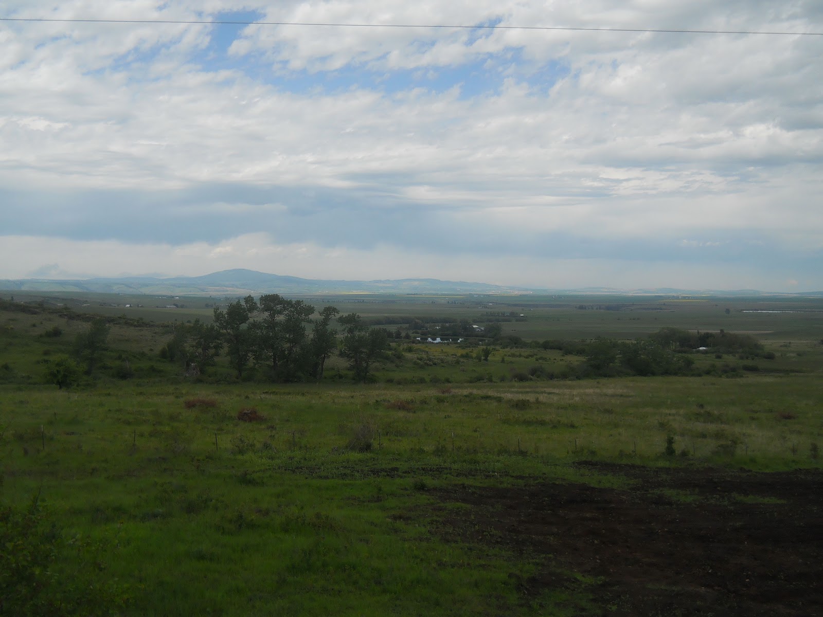
Here are some images of the Bitterroot Wilderness. Scenic Hwy 12 curved with the river as it wound its way through Western Montana. This is also where the Nez Perce National Historic Park was, so you will read about the history of the area along this river.


During General Howard's 1877 Nez Perce campaign, Looking Glass and his band camped out here. Looking Glass told the US Army, "Leave us alone. We are living here peacefully and want no trouble." But after a military attack that destroyed his village, ruined his gardens, and captured 750 of their horses, he and his group joined other Nez Perce refugees and headed for the buffalo plains. Howard spent 3 more months pursuing Looking Glass, as well as Joseph, White Bird, and their warriors.

From here I went to Heart of the Mountain, which is a "place of beginning" for the Nez Perce people.

After the Clearwater Battle on the heights above here, which was July 11-12, 1877, the Indians crossed the Lolo Trail to Montana. General Howard had 600 troops and artillery and he finally found the Indian camp across the river. 24 brave Indians blocked his advance in the Nez Perce War, and 100 more pinned him in rifle pits for a day. Then, the Indians moved northward, while Howard followed without fighting. The Indians then moved East and away from Howard's troops.

During the mining boom, the town of Harpster had a hotel, livery barn, harness shop, saloons (of course), general stores, a drug store, and a blacksmith shop. William Jackson built a toll bridge across Clearwater River, but the expected railroad never made it this far. The mines, however, really helped this area grow.
There's a road from Harpster to Elk City just above the main road (Hwy 12) that follows the river. Sections of that steep and narrow road run close to a much older trail called the Nez Perce trail that led to Montana's buffalo country and the Snake River plain. They started using this route as soon as they had horses, and both roads (the Elk City Wagon Road and the trail) gave travelers access to long distance hunting and isolated mining camps.

Below is a picture of Camas Prairie, named after the blue flowering Camas - a root food for Indians.
Tolo Lake provided a campground for Joseph and White Bird's bands when war broke out on the Salmon River June 14, 1877. Both bands were under military pressure to settle on Camas Prairie when 3 young men from White Bird's band avenged a number of past wrongs and the army retaliated.

From here, I went up White Bird mountain. This road used to make up Idaho's only north-south highway. Many tortuous curves and switchbacks (which put together make 37 complete circles) let this old road climb 2900 feet in 14 miles, gaining an elevation of 4429 at its summit. It was completed in 1915, which was a significant engineering and construction achievement for that time.
These pictures look down to the White Bird Battlefield, which was the site of the first battle in the Nez Perce war of 1877. To both sides, the conflict was about land, but their perception of the land was very different. These hills, with their streams and rich grasses are a small part of the 17 million acre homeland where the Nez Perce lived for thousands of years. Miners, farmers, and loggers saw other uses for the land and swept in to start using it for their purposes. The Treaty of 1855 designated a portion of the land for use as a reservation. Then, after gold was discovered, the Treaty of 1863 reduced the size of the Nez Perce reservation by 90%!! Many of the Nez Perce refused to leave their homes, which led to conflict and the start of the war.


After reading about the battle, I drove down to Tolo Lake. In early June 1877, 5 bands of Nimiipuu gathered here for their last taste of freedom before entering the Nez Perce reservation. The US Gov't had ordered them from their homelands, and threatened force if they did not comply. This place used to be full of happy memories, where these Indians came to harvest camas, play games, sing, race horses, and socialize in place. In 1877, it became a war camp.

What is also unusual about this lake is that over 400 mammoth bones were found here. How the lake formed over 10,000 years ago and why there are Colombian mammoth bones there is still a mystery.

This is Lawyer's Canyon, named for the Nez Perce Indian leader who served as head chief until 1871, and who lived near the lower end of the canyon. "The Lawyer" learned English and helped prepare dictionaries and translate the Bible into Nez Perce. He was also a friend of the whites and helped negotiate treaties.
In order to cross Lawyer's Canyon and the other camas gorges, high railroad bridges were built in 1908. Most were timber with a metal structure, and this one was 1500 feet long, and 296 ft high. In addition to the bridges, 7 railroad tunnels had to be blasted through the canyon to complete the railroad to Grangeville in 1908.

Along the way to Spalding - another part of the Nez Perce National Historic Park - I saw many fields of yellow. It was a stark contract to the greens, browns, and blues around it.

On the northwest part of Idaho, near Hwy 95, Henry Spalding established ID's first mission. Ever since the Indians first met Lewis and Clark, they wanted to learn more about the ways of the whites. In 1831 they delegated someone to go to St. Louis to meet Clark again and ask for teachers. Spalding came west. Within 2 months, a mission school was built and teaching students. The mission was moved to Clearwater a few years later.
This is the Bredell Family Cemetery.

The Watson Store was typical of small community general stores on the Nez Perce reservation in the early 1900s. Aside from food, it had hardware, beads (for decoration) and canvas. They often accepted bartered goods rather than cash.

The Spalding Presbyterian Church held its first service in 1876. A number of Nez Perce embraced Spalding's religion, and soon there were Indian ministers, hymns in Nez Perce, and Indian decorations at the church.
"The introduction of Christianity had far-reaching effects upon our people - whether those be good or bad." - Allen Slickpoo, Sr

The train ran through the reservation, allowing Nez Perce to go to different areas quickly. There were also loggers and farmers who took it, and timber, grain, and horses from Nez Perce were transported out. The train went through ID and WA.

The Lapwai Mission Cemetery has generations of Nez Perce buried there, as well as Henry and Eliza Spalding. This is sacred ground to the Indians, and part of their connection to their homeland.


Built in 1862, this cabin was part of a thriving group of buildings on the reservation and was probably the residence of an employee.

From here, I drove through Hells Canyon (also known as Joseph Canyon) in the Wallowa-Whitman National Forest in WA and OR. There was a bad thunderstorm and I was a little bit worried about driving 80 miles to Enterprise through the steep winding canyon roads, but I opted to take my chances. Luckily, the weather ended up being worse behind me and not as bad in Enterprise, and I made it through most of the canyon before it started to pour. This was a beautiful canyon that is hard to capture in photos!


No comments:
Post a Comment